Lake Coatepeque
A caldera lake of deep blue that turns turquoise some years - volcanic slopes, weekend houses and swimming from wooden docks.
Updated 7 August 2026
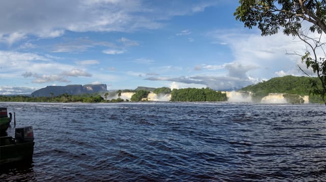
Coatepeque fills a volcanic caldera in western El Salvador, a deep blue crater lake ringed by steep green slopes with the Santa Ana volcano rising behind it. Every few years the water shifts to a milky turquoise for weeks or months - a phenomenon linked to volcanic and biological activity in the lake - and locals treat the change as an event. The shoreline is lined with weekend houses, small hotels and restaurants with wooden docks for swimming, and boats run out to the small island of Teopan. It is the standard escape from Santa Ana and San Salvador heat.
The landscape
- The caldera setting - deep blue water ringed by volcanic slopes.
- Swimming from the docks - lakeside platforms and warm water.
- Teopan island - the small island with pre-Columbian remains.
- Santa Ana volcano - the crater climb overlooking the lake.
When to go
The dry season from November to April gives the clearest weather and best views. Weekends bring Salvadoran families and full docks; weekdays are calm. The turquoise phase is unpredictable and cannot be planned for.
Things to know
Almost the entire shoreline is privately held by houses and hotels, so public access to the water is limited - most visitors pay a small fee at a restaurant or hotel for dock access, which is normal practice. The road down to the lake is steep and winding. Water quality has been a periodic concern with runoff from surrounding development.
Nearby
Santa Ana volcano and Cerro Verde park, Santa Ana city and the Ruta de las Flores.
Key facts
Source: Wikidata, item Q3045228, read on 18 October 2026.
What to pack for Lake Coatepeque
Chosen from what this place is for. Tap a kit for the full checklist.
- Reef-safe sunscreen - High SPF that will not bleach the coral you are swimming over. Find on Amazon
- Quick-dry towel - A microfibre towel packs small and dries in minutes. Find on Amazon
- Water shoes - Protect your feet on rocky entries, hot sand and sea-urchin spines. Find on Amazon
- Dry bag - Keeps phone, cash and keys safe while you are in the water. Find on Amazon
Some links on this page are Amazon affiliate links - if you buy through them we may earn a small commission at no extra cost to you.
All packing kitsPlan your trip
Where to start if Lake Coatepeque is going on the list.
Booking links on this page are affiliate links - if you book through them we may earn a small commission at no extra cost to you. It never changes what we write about a place.
Opening times, ticket prices and seasonal closures change - check the official source before you go: official site.