Pingualuit Crater
A near-perfect circle of the clearest water on earth, in a meteorite crater on the Ungava tundra.
Updated 21 October 2026

AI illustration
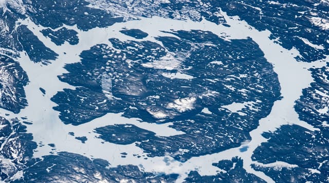
A meteorite struck the Ungava Peninsula about 1.4 million years ago, leaving a crater roughly three and a half kilometres across with a raised rim standing about a hundred and sixty metres above the tundra. It has no inlet or outlet: the lake in it is fed only by snow and rain, and the water is among the clearest ever measured, with a Secchi disc visible at around thirty-five metres, and one of the least saline lakes on earth. Arctic char live in it, apparently colonising during a wetter period. The name Pingualuit comes from the Inuit word for pimple, and the crater is protected in a national park in Nunavik.
What you'll find
- The circular crater - a rim standing 160 metres above flat tundra.
- The clear water - visibility to around thirty-five metres, among the world's clearest.
- The isolated lake - no inlet or outlet, fed only by precipitation.
- The Nunavik tundra - caribou, muskoxen and Inuit land use around the park.
When to go
July and August for hiking access, March and April for snowmobile travel over the snow; between those the ground is impassable. Access is only from Kangiqsujuaq with guides.
Things to know
Getting there means expensive flights to Nunavik and then a guided snowmobile trip or a multi-day hike. There is no accommodation in the park beyond basic huts. Weather grounds flights for days.
Nearby
Kangiqsujuaq is the gateway community; Hudson Strait lies north.
Key facts
Source: Wikidata, item Q1862522, read on 18 October 2026.
What to pack for Pingualuit Crater
Chosen from what this place is for. Tap a kit for the full checklist.
- Broken-in walking shoes or boots - Grip and ankle support matter more than looks; never hike in brand-new boots. Find on Amazon
- Warm base layers - Merino or synthetic against the skin - never cotton, which chills when damp. Find on Amazon
- Shelter suited to the place - Tent, tarp or hut booking - match it to the terrain and rules. Find on Amazon
- Layers + a waterproof shell - Mountain weather turns fast; a packable rain jacket saves the day. Find on Amazon
Some links on this page are Amazon affiliate links - if you buy through them we may earn a small commission at no extra cost to you.
All packing kitsPlan your trip
Where to start if Pingualuit Crater is going on the list.
Booking links on this page are affiliate links - if you book through them we may earn a small commission at no extra cost to you. It never changes what we write about a place.
Opening times, ticket prices and seasonal closures change - check the official source before you go: official site.