Vitosha Mountain
A mountain rising directly behind Sofia to 2,290 metres, with stone rivers of boulders on its slopes.
Updated 21 October 2026
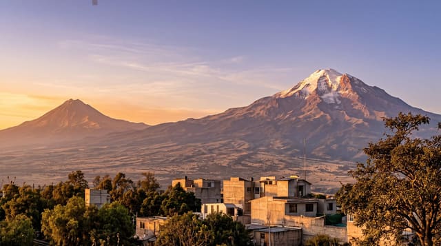
Vitosha rises immediately south of Sofia to 2,290 metres at Cherni Vrah, close enough that the city runs buses to the trailheads and the mountain functions as a park for a city of well over a million people. It was declared a protected area in 1934, which makes it the oldest nature park in the Balkans. Its distinguishing feature is geological: the moreni, or stone rivers, long ribbons of large rounded boulders running down the valleys, formed by frost shattering of the syenite and slow downslope movement, with streams audible underneath them. There is beech and spruce forest lower down, open subalpine grassland above, chairlifts from two sides, marked paths in every direction, and skiing in winter on slopes that are modest but ten minutes from the capital.
The landscape
- The stone rivers - ribbons of boulders with water running beneath them.
- Cherni Vrah at 2,290 metres - the summit plateau above Sofia.
- The oldest park in the Balkans - protected since 1934.
- Chairlifts from the city edge - lifts running from Dragalevtsi and Simeonovo.
When to go
May to October for walking and December to March for snow. A day. Weekends bring very large numbers of Sofians; weekdays are far quieter. Lifts run on limited days outside the winter season.
Practical notes
Chairlifts operate on an unpredictable schedule and are often closed. Weekend crowds on the main paths are heavy. Weather changes fast on the plateau and the summit is exposed. Litter near the road access points is a problem.
Nearby
Sofia is at the foot; Rila and the Seven Lakes lie south.
Key facts
Source: Wikidata, item Q378943, read on 18 October 2026.
What to pack for Vitosha Mountain
Chosen from what this place is for. Tap a kit for the full checklist.
- Broken-in walking shoes or boots - Grip and ankle support matter more than looks; never hike in brand-new boots. Find on Amazon
- Warm base layers - Merino or synthetic against the skin - never cotton, which chills when damp. Find on Amazon
- Layers for big temperature swings - Warm sun by day, near-freezing at night, even near the equator. Find on Amazon
- Layers + a waterproof shell - Mountain weather turns fast; a packable rain jacket saves the day. Find on Amazon
Some links on this page are Amazon affiliate links - if you buy through them we may earn a small commission at no extra cost to you.
All packing kitsPlan your trip
Where to start if Vitosha Mountain is going on the list.
Booking links on this page are affiliate links - if you book through them we may earn a small commission at no extra cost to you. It never changes what we write about a place.
Opening times, ticket prices and seasonal closures change - check the official source before you go: official site.