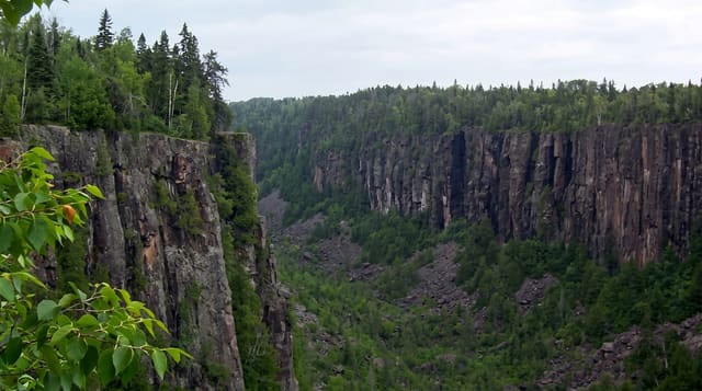
Vrbas Canyon
The gorge the Vrbas cuts between Jajce and Banja Luka, run commercially for rafting and lined by a cliff road.
Updated 1 September 2026
Between Jajce and Banja Luka the Vrbas cuts a canyon through limestone for around sixty kilometres, with walls rising several hundred metres and the road running along the water for much of it, which makes the drive itself a reason to take the route. The river is dammed in two places but the free sections are rafted commercially, class two and three in normal water with harder stretches when it is high, and the 2009 world rafting championship was held here, which built the operator base. Tijesno, the narrowest section, is the tightest part of the gorge. Rock climbing routes have been bolted on the canyon walls and via ferrata routes added.
What's there
- Tijesno - the narrowest section of the gorge.
- The rafting sections - the free-flowing stretches run commercially.
- The canyon road - the route along the water between the walls.
- Climbing routes - the bolted lines and via ferrata on the cliffs.
When to go
April to September for rafting, with the highest water in spring from snowmelt and the warmest in July and August. The road is open year round. Dam releases affect levels on the free sections.
Practical notes
Two dams interrupt the canyon and the free sections are shorter than the gorge length suggests. Rafting operators vary in standards and equipment. The road is narrow with heavy traffic in places. Water levels depend on dam operation.
Nearby
Banja Luka lies north; Jajce is south at the head of the canyon.
What to pack for Vrbas Canyon
Chosen from what this place is for. Tap a kit for the full checklist.
- Broken-in walking shoes or boots - Grip and ankle support matter more than looks; never hike in brand-new boots. Find on Amazon
- Quick-dry clothing - Board shorts or synthetics that shrug off spray and dry fast. Find on Amazon
- Layers + a waterproof shell - Mountain weather turns fast; a packable rain jacket saves the day. Find on Amazon
- Secure water shoes or reef boots - Grip on slippery launches and protection on rocky shores. Find on Amazon
Some links on this page are Amazon affiliate links - if you buy through them we may earn a small commission at no extra cost to you.
All packing kitsPlan your trip
Where to start if Vrbas Canyon is going on the list.
Booking links on this page are affiliate links - if you book through them we may earn a small commission at no extra cost to you. It never changes what we write about a place.
Opening times, ticket prices and seasonal closures change - check the official source before you go: official site.