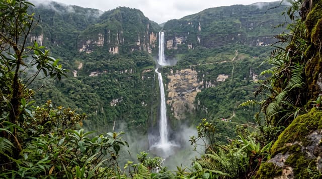
Umbal Falls
A staircase of glacial meltwater falls in East Tyrol, followed by Austria's first water-themed nature trail.
Updated 21 October 2026
The Isel rises off the Umbal glacier under the Grossvenediger and drops through a series of falls and gorges at the head of the Virgental in East Tyrol, and the Umbalfälle are the result - a sequence of cataracts over about two kilometres, fed entirely by glacier melt so the flow peaks on hot afternoons and drops overnight. The Wasserschaupfad, opened in 1988, was the first nature trail in Austria built specifically around water, with platforms out over the chutes, a suspension bridge and interpretation on how meltwater shapes rock. It is inside the Hohe Tauern National Park. The Isel below is the last major glacially-fed river in the Eastern Alps that has never been dammed.
The landscape
- Glacier-fed cataracts - two kilometres of falls off the Umbal ice.
- Austria's first water trail - the 1988 Wasserschaupfad with platforms over the chutes.
- Flow that peaks in the afternoon - meltwater rather than rain-driven.
- An undammed glacial river - the Isel, the last of its kind in the Eastern Alps.
When to go
June to September; afternoons for the strongest flow. A day.
Good to know
The approach from Ströden is about an hour up on foot. Spray makes the platforms wet and cold. Snow closes the trail outside summer. Meltwater is dangerous - stay off the rocks.
Nearby
Prägraten and the Virgental villages are below; Matrei in Osttirol is east.
Key facts
Source: Wikidata, item Q1548887, read on 18 October 2026.
What to pack for Umbal Falls
Chosen from what this place is for. Tap a kit for the full checklist.
- Broken-in walking shoes or boots - Grip and ankle support matter more than looks; never hike in brand-new boots. Find on Amazon
- Warm base layers - Merino or synthetic against the skin - never cotton, which chills when damp. Find on Amazon
- Shelter suited to the place - Tent, tarp or hut booking - match it to the terrain and rules. Find on Amazon
- Layers + a waterproof shell - Mountain weather turns fast; a packable rain jacket saves the day. Find on Amazon
Some links on this page are Amazon affiliate links - if you buy through them we may earn a small commission at no extra cost to you.
All packing kitsPlan your trip
Where to start if Umbal Falls is going on the list.
Booking links on this page are affiliate links - if you book through them we may earn a small commission at no extra cost to you. It never changes what we write about a place.
Opening times, ticket prices and seasonal closures change - check the official source before you go: official site.