Kals am Grossglockner
The East Tyrolean mountaineering village at the foot of the Grossglockner, start of the main route up from the Tyrolean side.
Updated 18 October 2026
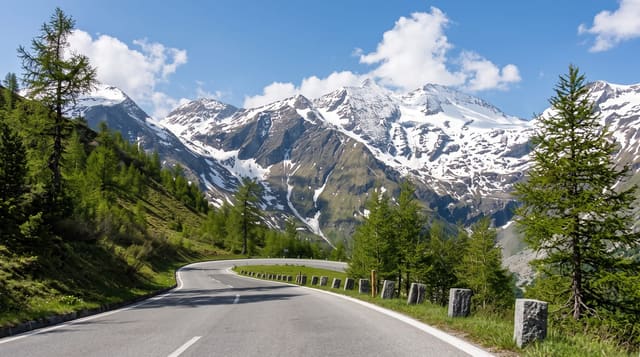
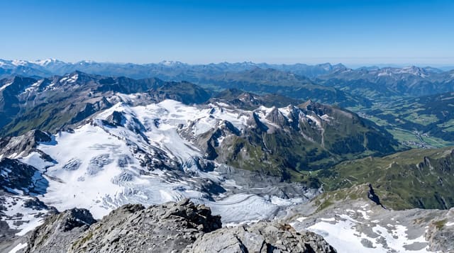
Kals sits at about thirteen hundred metres at the head of a valley running north from the Iselal into the Hohe Tauern, and it is the main approach to the Grossglockner from the Tyrolean side; the first ascent, in July 1800, an expedition organised by Franz Xaver von Salm-Reifferscheidt, prince-bishop of Gurk, came up from Heiligenblut on the Carinthian side. The normal route still goes from here through the Stüdlhütte and the Erzherzog-Johann-Hütte, the highest hut in Austria at 3,454 metres. The village keeps a guiding tradition and a mountaineering museum. Below the peak, the Kalser Tal and the Dorfertal are inside the national park, with walking to the Kalser Tauern and a road as far as the Lucknerhaus.
History
The Kals valley may have been settled as early as the Palaeolithic, Kals is first named on 19 August 1197, and a large copper mine opened here in the 16th century (Wikipedia, Kals am Großglockner).
The main sights
- The Grossglockner approach - the main route up from the Tyrolean side.
- A guiding village - the local tradition and the small mountaineering museum.
- Austria's highest hut - the Erzherzog-Johann-Hütte at 3,454 metres above.
- National park valleys - the Kalser Tal and Dorfertal walking country.
When to go
June to September; the high routes need settled weather. Two days.
Before you go
The Grossglockner is a serious glaciated climb needing a guide, equipment and experience - it is not a walk-up, and people die on it most years. The toll road ends well below the peak.
Nearby
Lienz is south; Heiligenblut and the high alpine road are over the ridge east.
Key facts
Source: Wikidata, item Q697575, read on 18 October 2026.
What to pack for Kals am Grossglockner
Chosen from what this place is for. Tap a kit for the full checklist.
- Layers for big temperature swings - Warm sun by day, near-freezing at night, even near the equator. Find on Amazon
- Comfortable walking shoes - Sightseeing means kilometres of pavement and cobbles daily. Find on Amazon
- Shelter suited to the place - Tent, tarp or hut booking - match it to the terrain and rules. Find on Amazon
- Extra-strong sun protection - Thin air means fierce UV; hat, sunglasses and high-SPF sunscreen. Find on Amazon
Some links on this page are Amazon affiliate links - if you buy through them we may earn a small commission at no extra cost to you.
All packing kitsPlan your trip
Where to start if Kals am Grossglockner is going on the list.
Booking links on this page are affiliate links - if you book through them we may earn a small commission at no extra cost to you. It never changes what we write about a place.
Opening times, ticket prices and seasonal closures change - check the official source before you go: official site.