Myall Lakes National Park
A system of coastal lakes and paperbark waterways behind the dunes, navigable by houseboat and canoe.
Updated 18 October 2026
AI illustration
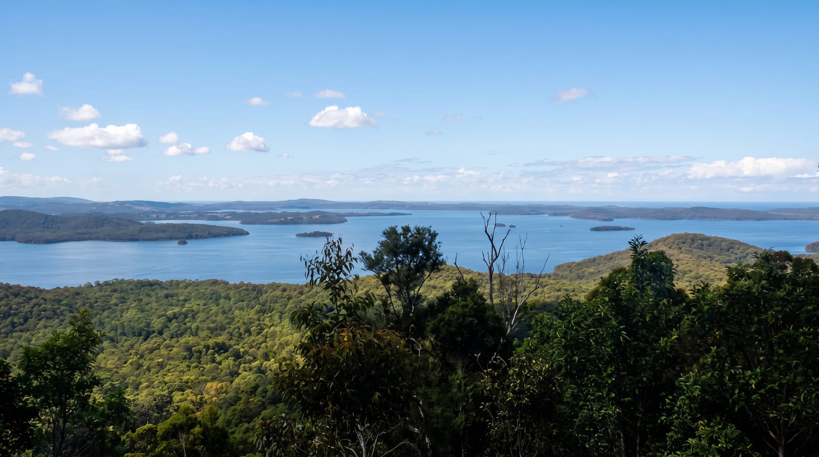
The Myall Lakes are a chain of shallow coastal lakes separated from the sea by dunes, fringed by paperbark and eucalypt forest and connected by narrow channels, forming the largest brackish lake system in New South Wales and a Ramsar-listed wetland. They are used for houseboating, sailing, canoeing and fishing, with hire boats operating from Bulahdelah and Tea Gardens and a small vehicle ferry crossing at Bombah Point. On the ocean side, Mungo Brush and Seal Rocks give surf beaches and the Sugarloaf Point lighthouse, and the coastal walk through littoral rainforest connects them. Campgrounds sit along both lake and beach, and dingoes are present in the park.
History
The Worimi people lived on this land for its abundant food, and the park holds spiritual sites central to their identity, among them Dark Point Aboriginal Place, where Worimi people have gathered for ceremonies and feasts for at least 4,000 years (Wikipedia, Myall Lakes National Park).
The landscape
- The lake system - shallow brackish lakes linked by narrow channels.
- The paperbark forest - swamp woodland along the water's edge.
- The houseboats - hire boats moving through the lakes and channels.
- The ocean side - Mungo Brush beach and the dunes between lake and sea.
When to go
September to May for boating and swimming; summer holidays fill campgrounds and houseboats, which need booking well ahead. Mosquitoes and midges are heavy around the lakes in warm, still weather. Winter is quiet and cool.
Good to know
Insects near the water are a genuine problem in summer evenings. The Bombah Point ferry is small, charges a fee and can queue in holidays. Dingoes are present and food must be secured. Vehicle entry fees apply at each entrance.
Nearby
Seal Rocks lies northeast on the coast; Tea Gardens and Hawks Nest are south.
Key facts
Source: Wikidata, item Q1581582, read on 18 October 2026.
What to pack for Myall Lakes National Park
Chosen from what this place is for. Tap a kit for the full checklist.
- Broken-in walking shoes or boots - Grip and ankle support matter more than looks; never hike in brand-new boots. Find on Amazon
- Travel rod + reel - A packable multi-piece rod fits in a case and covers most holiday fishing. Find on Amazon
- Reef-safe sunscreen - High SPF that will not bleach the coral you are swimming over. Find on Amazon
- Quick-dry clothing - Board shorts or synthetics that shrug off spray and dry fast. Find on Amazon
Some links on this page are Amazon affiliate links - if you buy through them we may earn a small commission at no extra cost to you.
All packing kitsPlan your trip
Where to start if Myall Lakes National Park is going on the list.
Booking links on this page are affiliate links - if you book through them we may earn a small commission at no extra cost to you. It never changes what we write about a place.
Opening times, ticket prices and seasonal closures change - check the official source before you go: official site.