Mornington Peninsula
A hook of land south of Melbourne with calm bay beaches on one side, ocean surf on the other, and vineyards between.
Updated 21 October 2026

AI illustration
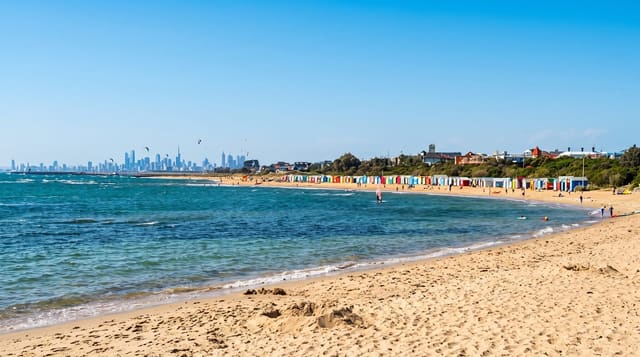
The Mornington Peninsula separates Port Phillip from Western Port and gives Melbourne its nearest coastline, with two entirely different shores: the bay side has flat, calm water, jetties and the brightly painted Victorian bathing boxes at Mount Martha and Dromana, while the back beaches face Bass Strait with heavy surf, rock platforms and rips. Between them, the hills hold one of Victoria's cooler wine regions, strong in pinot noir and chardonnay, with cellar doors, orchards and a maze garden. The Cape Schanck lighthouse and the Bushrangers Bay walk sit at the southern tip, Arthurs Seat has a gondola to a ridge lookout, and a ferry crosses from Sorrento to the Bellarine Peninsula.
History
The peninsula took shape when Port Phillip flooded at the end of the last glacial period, around 10,000 BC, and the Mayone-bulluk and Boonwurrung-Balluk clans of the Boonwurrung nation, perhaps 100 to 500 people, lived here before Europeans. The first European settlement in Victoria was the short-lived penal colony at Sullivan Bay, near Sorrento, founded in 1803 by Lieutenant-Colonel David Collins, and the peninsula's she-oak forests were soon cut for Melbourne's firewood and replaced by orchards. On 17 December 1967 Prime Minister Harold Holt went swimming at Cheviot Beach, now in Point Nepean National Park, and was never seen again (Wikipedia, Mornington Peninsula).
Highlights
- The two coasts - calm bay beaches on one side, Bass Strait surf on the other.
- The wine region - cool-climate cellar doors through the hills.
- Cape Schanck - the 1859 lighthouse and the cliff walk to Bushrangers Bay.
- Arthurs Seat - the gondola to a lookout over the bay and peninsula.
When to go
November to April for beach weather; January is extremely busy with Melbourne holidaymakers and traffic on the peninsula roads is heavy. Autumn is good for the wineries. Winter is cold and windy but quiet.
Before you go
Summer traffic and parking are genuinely difficult, and accommodation prices in January are steep. Back beaches have strong rips; only some are patrolled. The area is affluent and priced accordingly.
Nearby
Point Nepean is at the tip; Phillip Island lies east across Western Port.
Key facts
Source: Wikidata, item Q1413210, read on 18 October 2026.
What to pack for Mornington Peninsula
Chosen from what this place is for. Tap a kit for the full checklist.
- Reef-safe sunscreen - High SPF that will not bleach the coral you are swimming over. Find on Amazon
- Quick-dry clothing - Board shorts or synthetics that shrug off spray and dry fast. Find on Amazon
- Comfortable walking shoes - Sightseeing means kilometres of pavement and cobbles daily. Find on Amazon
- Quick-dry towel - A microfibre towel packs small and dries in minutes. Find on Amazon
Some links on this page are Amazon affiliate links - if you buy through them we may earn a small commission at no extra cost to you.
All packing kitsPlan your trip
Where to start if Mornington Peninsula is going on the list.
Booking links on this page are affiliate links - if you book through them we may earn a small commission at no extra cost to you. It never changes what we write about a place.
Opening times, ticket prices and seasonal closures change - check the official source before you go: official site.