Abra del Acay
One of the highest road passes in the world at nearly 5,000 metres, a rough gravel crossing on the RN40 with the Nevado de Acay above it.
Updated 21 October 2026
AI illustration
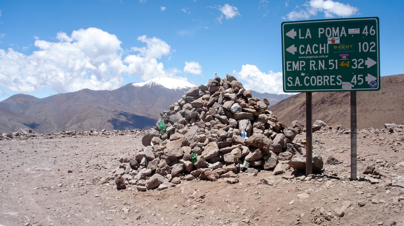
The Abra del Acay is the highest point on Argentina's RN40 and one of the highest passes reachable by ordinary road anywhere, topping out at 4,972 metres (an old sign there says 4,895) beneath the Nevado de Acay. The crossing links the puna town of San Antonio de los Cobres with the upper Calchaquí valley at La Poma, and it is entirely unpaved, a narrow track of loose stone that climbs in tight bends past mine workings and old refuges to a summit marked by a simple sign and, usually, a fierce wind. The reward is a view over ranks of Andean peaks and, on clear days, distant volcanoes on the Chilean border. Vehicles lose noticeable power in the thin air, and drivers are strongly advised not to attempt it alone or late in the day.
What to look for
- The summit marker - the pass at 4,972 metres (the old board says 4,895), with peak views.
- The Nevado de Acay - the mountain rising above the pass to over 5,700 metres.
- The gravel climb - tight switchbacks and loose stone on the ascent.
- The Andean panorama - ranks of peaks and distant volcanoes on clear days.
When to go
April to November, and even then only in settled weather; snow closes the pass in winter and summer rain washes out the track. Cross in the morning and never attempt it in the dark. Acclimatising for a night or two at San Antonio first is sensible.
Things to know
This is a demanding drive: no barriers, loose surface, no services, no phone signal and severe altitude that affects both people and engines. Breakdowns here are serious. Many rental agreements exclude it. Travellers with heart or breathing conditions should avoid it entirely.
Nearby
San Antonio de los Cobres is north; La Poma and the Calchaquí valley lie south.
Key facts
Source: Wikidata, item Q323302, read on 18 October 2026.
What to pack for Abra del Acay
Chosen from what this place is for. Tap a kit for the full checklist.
- Warm base layers - Merino or synthetic against the skin - never cotton, which chills when damp. Find on Amazon
- Layers for big temperature swings - Warm sun by day, near-freezing at night, even near the equator. Find on Amazon
- Comfortable walking shoes - Sightseeing means kilometres of pavement and cobbles daily. Find on Amazon
- An insulated + windproof jacket - A down or synthetic layer under a hard shell handles most cold. Find on Amazon
Some links on this page are Amazon affiliate links - if you buy through them we may earn a small commission at no extra cost to you.
All packing kitsPlan your trip
Where to start if Abra del Acay is going on the list.
Booking links on this page are affiliate links - if you book through them we may earn a small commission at no extra cost to you. It never changes what we write about a place.
Opening times, ticket prices and seasonal closures change - check the official source before you go: official site.