Tay Con Linh
The highest peak of the north-east at 2,428 metres, climbed through old shan tuyet tea trees.
Updated 30 August 2026
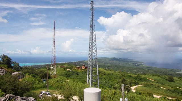
Tay Con Linh reaches 2,428 metres west of Ha Giang city and is the highest mountain in the north-eastern region, the roof of the range east of the Red River. The climb is done over two days with a guide and a camp on the ridge, through forest that changes with height - and on the lower slopes through stands of shan tuyet tea, old large-leaf trees several metres tall that Dao and H'mong families pick, some of them credibly a couple of centuries old. Rhododendron flowers on the ridge in spring. The summit is often in cloud and the ground is wet for most of the year.
Highlights
- The north-east's highest peak - 2,428 metres west of Ha Giang.
- Old shan tuyet tea trees - picked on the lower slopes.
- A two-day climb with a camp - the standard way up.
- Rhododendron on the ridge - flowering in spring.
When to go
October to April; spring for the rhododendron. Two days.
Things to know
A guide is required and porters are usual. Long stretches of the route are steep and greasy underfoot. Leeches are constant in the wet months. The summit is in cloud most days. It is cold on the ridge at night.
Nearby
Ha Giang city is east; Hoang Su Phi and its terraces are west.
Key facts
Source: Wikidata, item Q10831041, read on 18 October 2026.
What to pack for Tay Con Linh
Chosen from what this place is for. Tap a kit for the full checklist.
- Broken-in walking shoes or boots - Grip and ankle support matter more than looks; never hike in brand-new boots. Find on Amazon
- Layers for big temperature swings - Warm sun by day, near-freezing at night, even near the equator. Find on Amazon
- Layers + a waterproof shell - Mountain weather turns fast; a packable rain jacket saves the day. Find on Amazon
- Extra-strong sun protection - Thin air means fierce UV; hat, sunglasses and high-SPF sunscreen. Find on Amazon
Some links on this page are Amazon affiliate links - if you buy through them we may earn a small commission at no extra cost to you.
All packing kitsPlan your trip
Where to start if Tay Con Linh is going on the list.
Booking links on this page are affiliate links - if you book through them we may earn a small commission at no extra cost to you. It never changes what we write about a place.
Opening times, ticket prices and seasonal closures change - check the official source before you go: official site.