Mount Taranaki
A near-symmetrical volcanic cone standing alone on a coastal plain, ringed by a national park drawn as a circle around it.
Updated 21 October 2026
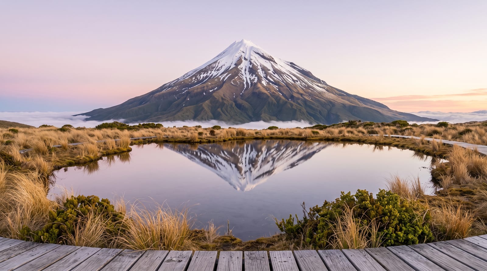
AI illustration
Taranaki stands alone on a coastal plain, a near-symmetrical volcanic cone with a smaller ridge on its northwestern flank, and its outline is regular enough that people assume the photographs have been tidied. The national park around it is a circle: the boundary was drawn as a radius from the summit, so from the air the forest ends in a clean arc against dairy farmland. Three roads climb to visitor centres on the slopes, and from them tracks run through goblin forest of twisted, moss-hung trees up into tussock and scoria. The best-known walk goes to the Pouakai tarns, where a shallow pool on a boggy plateau holds a reflection of the whole cone on still mornings.
History
The mountain was tapu to Māori and not climbed by them at the time of European settlement; the whaler James Heberley and the naturalist Ernst Dieffenbach reached the summit in 1839. Its likeness to Mount Fuji made it the backdrop for the 2003 film The Last Samurai, and since 2025 its only official name has been Taranaki Maunga (Wikipedia, Mount Taranaki).
What's there
- The cone from the plain - the symmetrical volcano rising straight out of farmland.
- The Pouakai tarns - shallow pools that mirror the mountain on windless mornings.
- Goblin forest - twisted, moss-covered kamahi woods on the lower slopes.
- Dawson Falls - the waterfall on the southeastern side, near one of the road ends.
When to go
December to March gives the most settled weather and the least snow on the upper tracks, though the mountain makes its own cloud and can stay hidden for days at a stretch in any month. Early morning is the only reliable window for still water at the tarns. Winter turns the upper slopes into an alpine environment that needs ice axe and crampons.
Before you go
Taranaki is in cloud far more often than it is out, and plenty of people spend three days nearby without seeing it. The tarns walk is a long, steep climb with a great many steps, not the short stroll the reflection photos suggest, and the boardwalk there is small and crowded at sunrise. The summit route is an alpine climb and people get into serious trouble on it every year.
Nearby
New Plymouth and its coastal walkway are half an hour away, with the Taranaki surf beaches beyond.
Key facts
Source: Wikidata, item Q850051, read on 18 October 2026.
What to pack for Mount Taranaki
Chosen from what this place is for. Tap a kit for the full checklist.
- Broken-in walking shoes or boots - Grip and ankle support matter more than looks; never hike in brand-new boots. Find on Amazon
- Reef-safe sunscreen - High SPF that will not bleach the coral you are swimming over. Find on Amazon
- Quick-dry clothing - Board shorts or synthetics that shrug off spray and dry fast. Find on Amazon
- Warm base layers - Merino or synthetic against the skin - never cotton, which chills when damp. Find on Amazon
Some links on this page are Amazon affiliate links - if you buy through them we may earn a small commission at no extra cost to you.
All packing kitsPlan your trip
Where to start if Mount Taranaki is going on the list.
Booking links on this page are affiliate links - if you book through them we may earn a small commission at no extra cost to you. It never changes what we write about a place.
Opening times, ticket prices and seasonal closures change - check the official source before you go: official site.