Mui Dinh
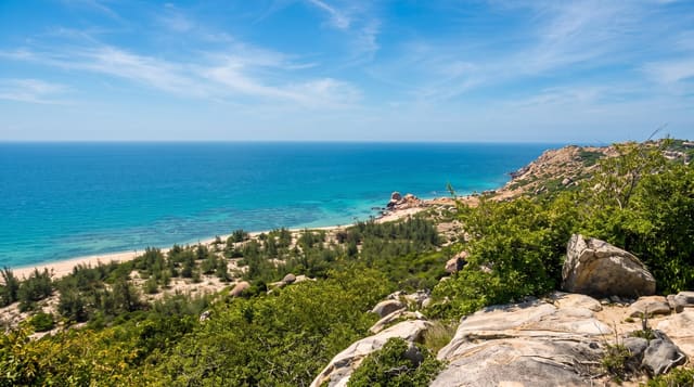
A cape of sand dunes and boulders in the driest corner of Vietnam, with a French lighthouse above it.
Updated 30 August 2026
Mui Dinh is a headland south of Phan Rang in Ninh Thuan, the driest province in Vietnam, and the landscape is accordingly unlike the rest of the country: sand dunes running down to the sea, granite boulders piled on the slopes, cactus and thorn scrub, and almost no vegetation otherwise. A lighthouse built by the French in 1904 stands on the point, reached by a track and then a climb up steps. The dunes below are used for sandboarding and camping. Wind is constant here, which is why the province carries most of Vietnam's wind farms, and shade is nonexistent.
Highlights
- Dunes running to the sea - in the driest province in Vietnam.
- Granite boulders and thorn scrub - the rest of the landscape.
- A lighthouse of 1904 - built by the French on the point.
- Constant wind - which is why the wind farms are here.
When to go
November to April; midsummer is brutally hot. A full day.
Things to know
There is no shade anywhere and the sand gets extremely hot. The walk to the lighthouse is exposed. There are no facilities. Water must be carried. Camping here is done without infrastructure.
Nearby
Ca Na is south; Phan Rang and Bau Truc are north.
Key facts
Source: Wikidata, item Q110637496, read on 18 October 2026.
What to pack for Mui Dinh
Chosen from what this place is for. Tap a kit for the full checklist.
- Broken-in walking shoes or boots - Grip and ankle support matter more than looks; never hike in brand-new boots. Find on Amazon
- Loose, light, long clothing - Covering up beats bare skin in the desert - and locals dress this way for a reason. Find on Amazon
- Shelter suited to the place - Tent, tarp or hut booking - match it to the terrain and rules. Find on Amazon
- Layers + a waterproof shell - Mountain weather turns fast; a packable rain jacket saves the day. Find on Amazon
Some links on this page are Amazon affiliate links - if you buy through them we may earn a small commission at no extra cost to you.
All packing kitsPlan your trip
Where to start if Mui Dinh is going on the list.
Booking links on this page are affiliate links - if you book through them we may earn a small commission at no extra cost to you. It never changes what we write about a place.
Opening times, ticket prices and seasonal closures change - check the official source before you go: official site.