Dong Van Karst Plateau
A UNESCO Global Geopark of limestone mountains and deep canyons in Hà Giang, Vietnam's northernmost province, home to 17 ethnic minority groups.
Updated 7 November 2026
AI illustration
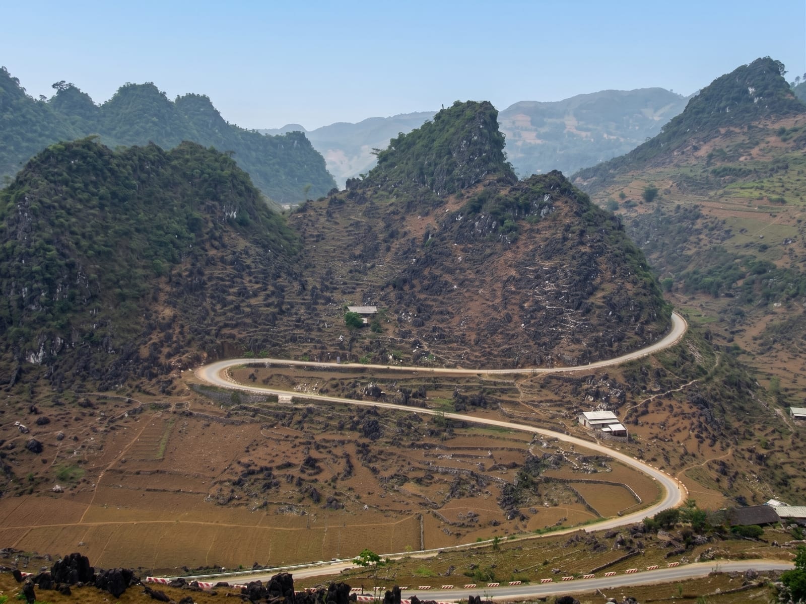
Dong Van Karst Plateau Geopark covers most of four districts of Hà Giang, Vietnam's northernmost province, Mèo Vạc, Đồng Văn, Yên Minh and Quản Bạ, on the border with China, and it has belonged to the UNESCO Global Geoparks Network and the Asia Pacific Geoparks Network since 3 October 2010. Its 2,356.8 km² (910 sq mi) lie at an average height of 1,400 to 1,600 m (4,593 to 5,249 ft), and about 80 per cent is limestone, with mountains rising to 1,971 m (6,467 ft) on Mount Mieu Vac and canyons such as Tu San, Vietnam's deepest at about 800 m (2,625 ft). Its rocks span seven stages from the Cambrian, about 550 million years ago, to the present, including two mass-extinction boundaries, and the oldest fossil found here, at Lũng Cú peak, is 540 million years old. Two nature reserves shelter conifers, Asian black bears, southern serows and the Tonkin snub-nosed monkey, found only in Hà Giang and thought extinct until the early 1990s, and 17 ethnic minority groups live in the geopark, among them the Hmong, Dao, La Chí, Pu Péo, Lô Lô, Tày and Nùng.
Background
Dong Van Karst Plateau Geopark lies in Hà Giang, Vietnam's northernmost province, on the border with China, and has been part of the UNESCO Global Geoparks Network since 2010. It takes in most of the districts of Đồng Văn, Mèo Vạc, Quản Bạ and Yên Minh at an average height of 1,400 to 1,600 m, and about 80 per cent of it is limestone, rising to 1,971 m on Mount Mieu Vac and cut by the Tu San canyon, around 800 m deep. Its rocks record the history of the Earth from the Cambrian onwards, and it is home to 17 peoples, among them the Hmong, Dao and Tày.
Source: Wikipedia, "Dong Van Karst Plateau Geopark"
Highlights
- Mã Pí Lèng Pass - one of the main geosites, in Mèo Vạc district.
- Tu San Canyon - Vietnam's deepest, about 800 m (2,625 ft) deep and 1.7 km long, with cliffs of 70 to 90 degrees.
- Lũng Cú Peak - in Đồng Văn district, where the geopark's oldest fossil, 540 million years old, was found.
- The Fairy Bosom peaks - a geosite in Quản Bạ district.
When to go
Most of the geopark has a temperate climate with a rainy and a dry season, and although the annual mean is put at 24 to 28 °C (75 to 82 °F), winter temperatures can fall to 5 °C (41 °F).
Practical notes
This is a large, spread-out area covering most of four districts, and its main geosites are scattered across Mèo Vạc, Đồng Văn and Quản Bạ.
Nearby
From the centre of the geopark, the town of Mèo Vạc is about 22 km east-south-east and Lũng Cú peak about 22 km north-north-east, while Hanoi is about 250 km south-south-east, all in a straight line.
Key facts
Source: Wikidata, item Q10744325, read on 18 October 2026.
What to pack for Dong Van Karst Plateau
Chosen from what this place is for. Tap a kit for the full checklist.
- Broken-in walking shoes or boots - Grip and ankle support matter more than looks; never hike in brand-new boots. Find on Amazon
- Layers for big temperature swings - Warm sun by day, near-freezing at night, even near the equator. Find on Amazon
- Layers + a waterproof shell - Mountain weather turns fast; a packable rain jacket saves the day. Find on Amazon
- Extra-strong sun protection - Thin air means fierce UV; hat, sunglasses and high-SPF sunscreen. Find on Amazon
Some links on this page are Amazon affiliate links - if you buy through them we may earn a small commission at no extra cost to you.
All packing kitsPlan your trip
Where to start if Dong Van Karst Plateau is going on the list.
Booking links on this page are affiliate links - if you book through them we may earn a small commission at no extra cost to you. It never changes what we write about a place.
Opening times, ticket prices and seasonal closures change - check the official source before you go: official site.