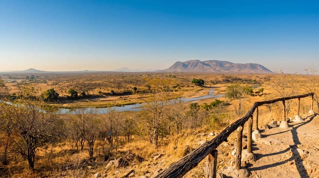
Lake Rukwa
A shallow alkaline lake with no outlet in the western rift, whose level rises and falls dramatically.
Updated 21 October 2026
Rukwa lies in an arm of the western rift with no outlet, so everything flowing in stays in and evaporates, leaving the water alkaline and salty. The lake lies at about 800 metres, midway between Lake Tanganyika and Lake Malawi, and is the third largest body of inland water in the country. Its level swings enormously between wet and dry years - in 1929 it was only about 48 kilometres long - and it has at times split into two lakes and at others joined into one long body over a hundred and eighty kilometres. Pelicans, flamingos and storks use the shallows in numbers, crocodiles are abundant, and fish populations boom and crash with the water.
The landscape
- The changing level - a lake that splits and rejoins as the water rises and falls.
- The waterbirds - pelicans, flamingos and storks working the alkaline shallows.
- The crocodiles - a large population along the shoreline and river mouths.
- The rift setting - escarpments rising on either side of the basin.
When to go
June to October for the roads and for concentrations of birds on the shrinking water. The wet season makes access very difficult. Water levels vary greatly between years.
Good to know
There is essentially no visitor infrastructure and no accommodation at the lake. Roads in the basin are poor and often impassable when wet. Crocodiles make the shoreline dangerous.
Nearby
Katavi is northwest, and Mbeya is southeast.
Key facts
Source: Wikidata, item Q1143935, read on 18 October 2026.
What to pack for Lake Rukwa
Chosen from what this place is for. Tap a kit for the full checklist.
- Reef-safe sunscreen - High SPF that will not bleach the coral you are swimming over. Find on Amazon
- Quick-dry towel - A microfibre towel packs small and dries in minutes. Find on Amazon
- Water shoes - Protect your feet on rocky entries, hot sand and sea-urchin spines. Find on Amazon
- Dry bag - Keeps phone, cash and keys safe while you are in the water. Find on Amazon
Some links on this page are Amazon affiliate links - if you buy through them we may earn a small commission at no extra cost to you.
All packing kitsPlan your trip
Where to start if Lake Rukwa is going on the list.
Booking links on this page are affiliate links - if you book through them we may earn a small commission at no extra cost to you. It never changes what we write about a place.
Opening times, ticket prices and seasonal closures change - check the official source before you go: official site.