Engaruka Ruins
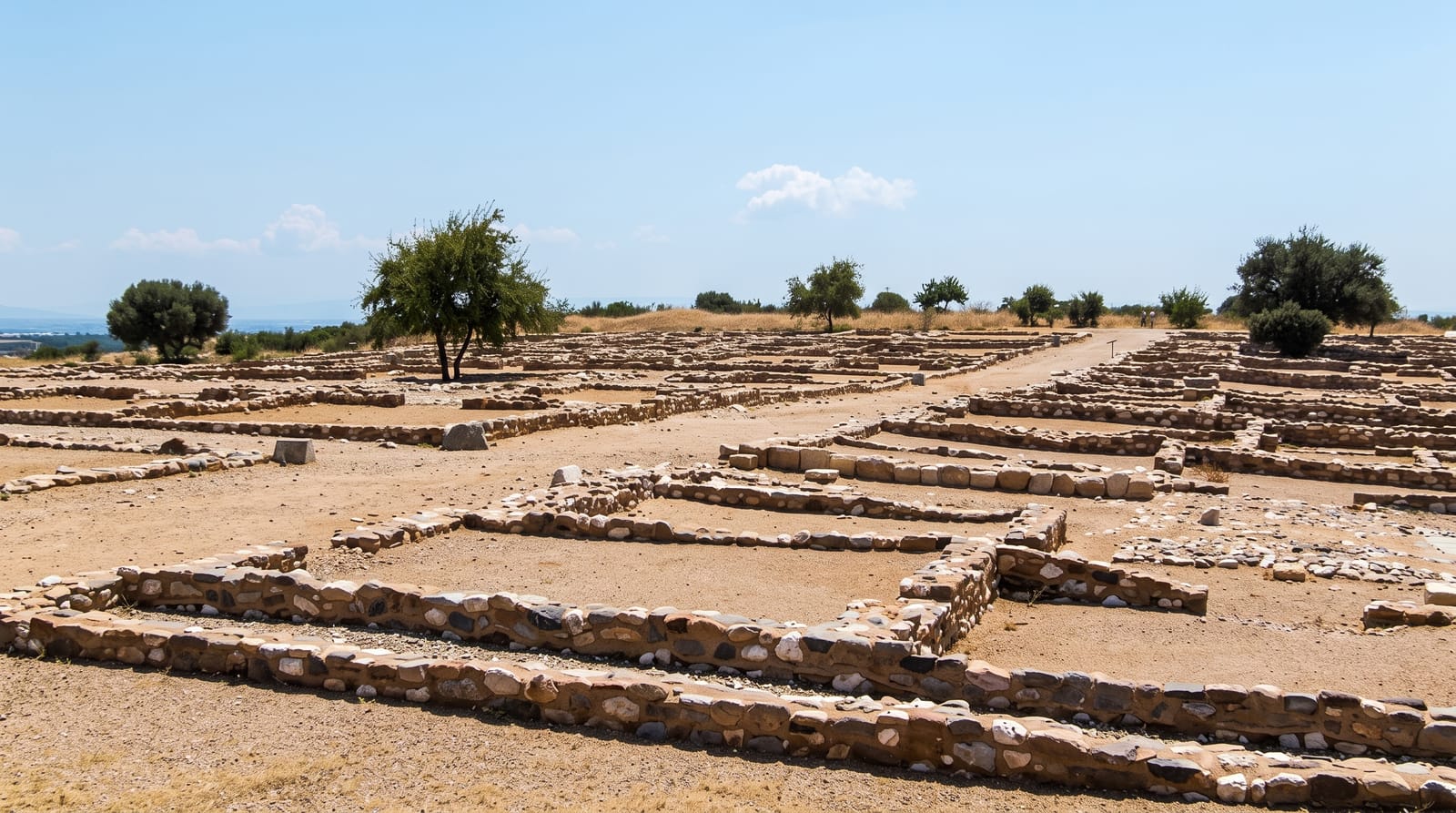
The remains of a large stone-built irrigation system abandoned centuries ago at the foot of the Rift wall.
Updated 2 September 2026
At Engaruka the ground below the Rift escarpment is covered with the remains of a farming system built in stone: channels leading water from the escarpment streams, terraces, field boundaries and the foundations of houses spread over several square kilometres. It supported a substantial population from around the fifteenth century and was abandoned by the nineteenth, probably as the water supply failed. It is one of the largest abandoned agricultural systems known in sub-Saharan Africa.
What you'll find
- The stone channels - the irrigation network leading water from the escarpment.
- The terraces - stone-walled field systems covering several square kilometres.
- The house foundations - the outlines of the settlement among the fields.
- The escarpment - the Rift wall the whole system was built to draw water from.
When to go
June to October for the roads and for walking the site. The rains make the tracks difficult. Mornings are coolest for the walk.
Things to know
The remains are low stone lines and take imagination to read; there is little interpretation on site. Guides are compulsory and their knowledge varies. The road in is rough and the site is hot and exposed.
Nearby
Mto wa Mbu is south, and Ol Doinyo Lengai is north.
Key facts
Source: Wikidata, item Q2761613, read on 18 October 2026.
What to pack for Engaruka Ruins
Chosen from what this place is for. Tap a kit for the full checklist.
- Loose, light, long clothing - Covering up beats bare skin in the desert - and locals dress this way for a reason. Find on Amazon
- Comfortable walking shoes - Sightseeing means kilometres of pavement and cobbles daily. Find on Amazon
- A wide-brim hat + sunglasses - Shade for your face and eyes where there is none overhead. Find on Amazon
- A slim anti-theft daypack - Zips that close properly; keep it in front in crowds and on transit. Find on Amazon
Some links on this page are Amazon affiliate links - if you buy through them we may earn a small commission at no extra cost to you.
All packing kitsPlan your trip
Where to start if Engaruka Ruins is going on the list.
Booking links on this page are affiliate links - if you book through them we may earn a small commission at no extra cost to you. It never changes what we write about a place.
Opening times, ticket prices and seasonal closures change - check the official source before you go: official site.