Gornergrat
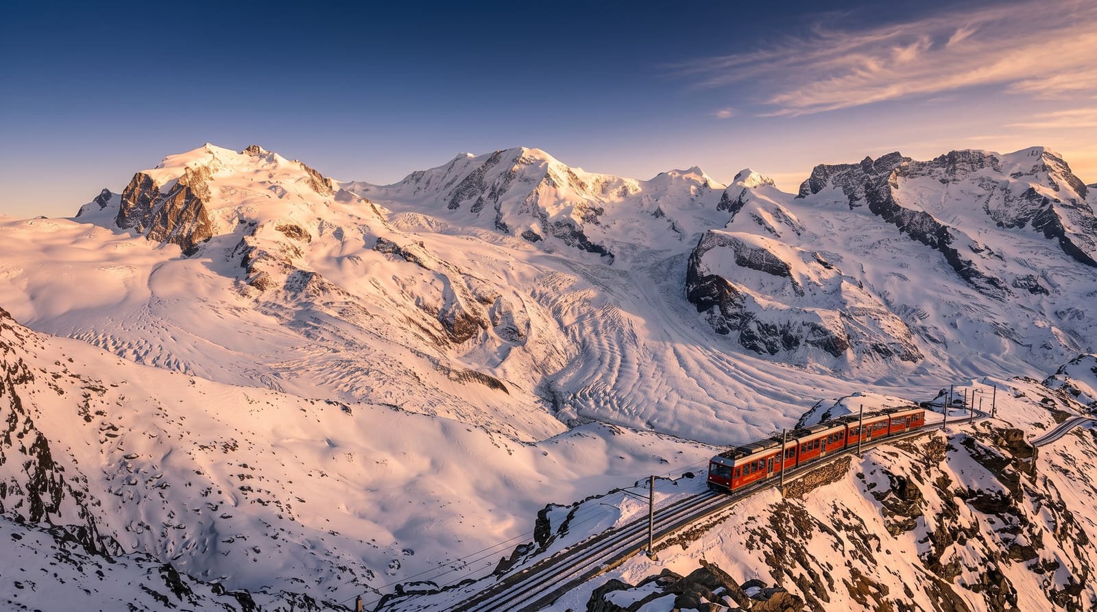
A ridge above Zermatt at just over three thousand metres, reached by rack railway, looking straight down onto the Gorner Glacier.
Updated 21 October 2026
AI illustration
Zermatt is car free, and the railway that leaves from opposite the main station has been climbing the eastern side of the valley since 1898, when it was the first electric rack railway built in Switzerland. In a little over half an hour it lifts you to the Gornergrat ridge at just over three thousand metres. The ground on the far side drops to the Gorner Glacier, a wide grey and white sheet running back into a wall of high peaks that includes Monte Rosa and its Dufourspitze, the highest summit in the country, while the Matterhorn stands in profile across the valley. From the top some 29 summits over four thousand metres are in view, and the line is the highest open-air railway in Europe. Two observatory domes, installed in the late 1960s, sit in the towers of the hotel, and marked paths lead back down to the intermediate stations.
Highlights
- The Gorner Glacier - a broad ice sheet running back into the peaks below the ridge.
- Monte Rosa and the Dufourspitze - the highest ground in Switzerland, seen across the ice.
- The rack railway - electric since 1898, climbing through larch, meadow and bare rock.
- The walk down - marked paths from the ridge to Rotenboden and Riffelberg.
When to go
Trains run all year. June to October is the walking season, when the paths down to Riffelsee and Riffelberg are clear and the small lakes hold a reflection of the Matterhorn in still morning air. Cloud usually builds around the peaks by late morning, so take an early train and look at the webcams before you buy a ticket.
Good to know
The fare is high even by Swiss standards and rail passes only reduce it. In cloud you pay a great deal to stand in grey. The ridge is developed, with a hotel, shops and a terrace that fills as each train arrives, so quiet lasts about four minutes. At three thousand metres some people get a headache and find the short climbs harder than expected.
Nearby
Zermatt lies below, with the Matterhorn opposite and the Klein Matterhorn lifts across the valley.
Key facts
Source: Wikidata, item Q666796, read on 18 October 2026.
What to pack for Gornergrat
Chosen from what this place is for. Tap a kit for the full checklist.
- Broken-in walking shoes or boots - Grip and ankle support matter more than looks; never hike in brand-new boots. Find on Amazon
- Spare batteries + cards - Cold and long shoots drain power; never run out at the good light. Find on Amazon
- Warm base layers - Merino or synthetic against the skin - never cotton, which chills when damp. Find on Amazon
- Layers for big temperature swings - Warm sun by day, near-freezing at night, even near the equator. Find on Amazon
Some links on this page are Amazon affiliate links - if you buy through them we may earn a small commission at no extra cost to you.
All packing kitsPlan your trip
Where to start if Gornergrat is going on the list.
Booking links on this page are affiliate links - if you book through them we may earn a small commission at no extra cost to you. It never changes what we write about a place.
Opening times, ticket prices and seasonal closures change - check the official source before you go: official site.