Malin Head
The northernmost point of Ireland, a wind-scoured headland with a ruined signal tower, sea chasms and very dark night skies.
Updated 4 September 2026

AI illustration
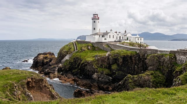
Malin Head is the northernmost point of the island of Ireland, a low, wind-scoured headland of layered rock at the top of the Inishowen Peninsula. The high ground, called Banba's Crown, carries a ruined stone tower from 1805 and a car park that is often the windiest place you will stand all year. Paths run west along the cliff to Hell's Hole, a chasm where the sea forces in and back out with a sound you hear before you see anything. The coast here faces open water for a very long way north, which is why it turns up in aurora forecasts and in film locations. There is no shelter and no ticket.
The landscape
- Banba's Crown - the headland high point with its ruined tower of 1805.
- Hell's Hole - the narrow chasm where swell drives in and drains back.
- The cliff paths - open walking west along the edge toward Ballyhillin.
- Night skies - dark enough that aurora is sometimes visible north over the sea.
When to go
Late spring to early autumn for daylight and passable weather, though the wind blows here in every season. Aurora chances are better between September and March when the nights are long and occasionally clear. Come at either end of the day for low light on the rock. Nothing is booked and nothing closes, but facilities amount to a couple of car parks.
Things to know
This is a headland, not a monument, and people who drive two hours expecting a landmark find a car park, a ruined tower and a great deal of weather. The wind is genuinely hard to stand up in, the ground near the chasm is uneven and unfenced, and the last stretch of road is narrow. In poor visibility there is nothing to see at all.
Nearby
Ballyliffin and Carndonagh are south; the Inishowen coast road loops the peninsula.
Key facts
Source: Wikidata, item Q303076, read on 18 October 2026.
What to pack for Malin Head
Chosen from what this place is for. Tap a kit for the full checklist.
- Broken-in walking shoes or boots - Grip and ankle support matter more than looks; never hike in brand-new boots. Find on Amazon
- Spare batteries + cards - Cold and long shoots drain power; never run out at the good light. Find on Amazon
- Layers + a waterproof shell - Mountain weather turns fast; a packable rain jacket saves the day. Find on Amazon
- A compact tripod - Essential for night skies, aurora, waterfalls and low light. Find on Amazon
Some links on this page are Amazon affiliate links - if you buy through them we may earn a small commission at no extra cost to you.
All packing kitsPlan your trip
Where to start if Malin Head is going on the list.
Booking links on this page are affiliate links - if you book through them we may earn a small commission at no extra cost to you. It never changes what we write about a place.
Opening times, ticket prices and seasonal closures change - check the official source before you go: official site.