Seweweekspoort
A gravel road through a Swartberg cleft where the rock strata stand vertical and the walls change colour by the bend.
Updated 22 October 2026
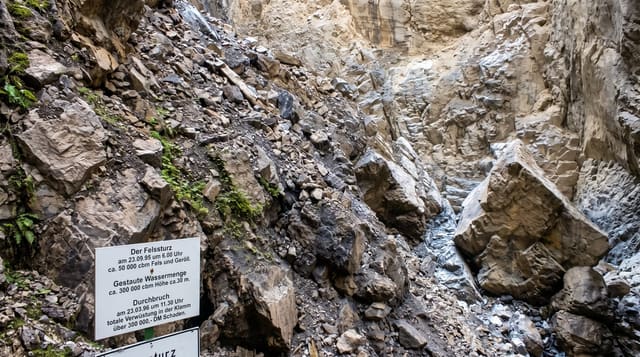
Seweweekspoort cuts about seventeen kilometres through the Swartberg between Ladismith and the Great Karoo, following a stream bed rather than climbing over a pass - which is why the road crosses the water repeatedly and why the walls stay close on both sides the whole way. The geology is the reason to drive it slowly: the Cape Fold Mountains were crumpled so hard here that the sandstone strata stand on end, and you pass through bands of red, grey, purple and cream rock tilted vertically like a shelf of books. Seweweekspoort Peak, at 2,325 metres the highest in the Western Cape, stands above the eastern side. The name is argued over - seven weeks, a missionary called Zeven Weeken, or smugglers' seven-week hideouts - and none of the explanations is settled. The road is unsurfaced but gentle, and it floods after heavy rain.
History
Building of the road through the poort began in the 1850s with prison labour, and it was completed in November 1862 and is still in use (Wikipedia, Seweweekspoort).
Highlights
- The vertical strata - sandstone bands tilted on end in red, grey and cream.
- The stream crossings - a road that follows the water rather than climbing a pass.
- Seweweekspoort Peak - the highest point in the Western Cape, above the eastern wall.
- The disputed name - several explanations, none of them settled.
When to go
March to May and September to November. Two hours to drive slowly with stops.
Good to know
Gravel with river crossings that flood after rain and close the road. There are no facilities, fuel or phone signal in the poort. Summer heat in the gorge is heavy. Corrugations shake low cars badly at speed - drive slowly.
Nearby
Ladismith is at the southern end; the Swartberg Pass and Prince Albert are east.
Key facts
Source: Wikidata, item Q3480859, read on 18 October 2026.
What to pack for Seweweekspoort
Chosen from what this place is for. Tap a kit for the full checklist.
- Broken-in walking shoes or boots - Grip and ankle support matter more than looks; never hike in brand-new boots. Find on Amazon
- Layers + a waterproof shell - Mountain weather turns fast; a packable rain jacket saves the day. Find on Amazon
- Daypack with rain cover - 20-30 litres holds water, snacks, layers and a first-aid kit. Find on Amazon
- Offline maps + a power bank - Download the trail before you lose signal; carry backup charge. Find on Amazon
Some links on this page are Amazon affiliate links - if you buy through them we may earn a small commission at no extra cost to you.
All packing kitsPlan your trip
Where to start if Seweweekspoort is going on the list.
Booking links on this page are affiliate links - if you book through them we may earn a small commission at no extra cost to you. It never changes what we write about a place.
Opening times, ticket prices and seasonal closures change - check the official source before you go: official site.