Breitachklamm
The deepest rock gorge in central Europe, opened in 1905 by a priest who raised the money himself.
Updated 21 October 2026
AI illustration
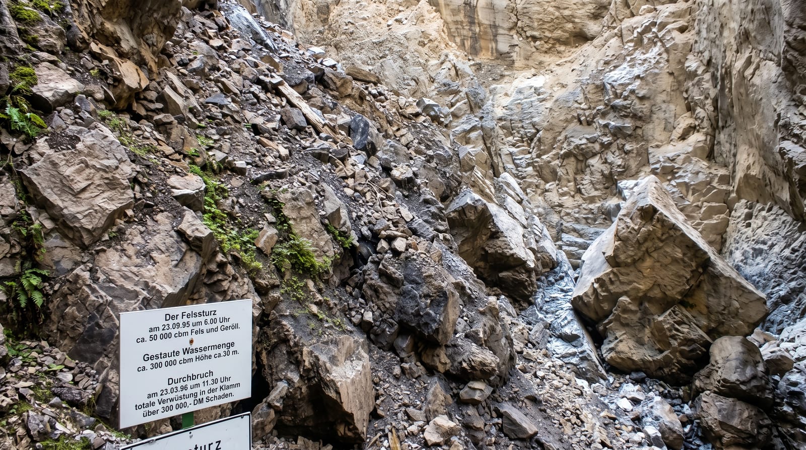
The Breitach cut a gorge about a hundred and fifty metres deep and in places only two metres wide, and until the twentieth century it was impassable. A local priest, Johannes Schiebel, raised the funds and drove the project to blast a path through it, opened in 1905, which runs about four hundred metres along galleries and through tunnels above the water. A rockfall in September 1995 sent some 50,000 cubic metres of rock and debris into the gorge, destroying sections and closing the path for repairs. In winter the gorge freezes into ice curtains and columns and stays open, lit for evening visits, which is when many people prefer it.
History
For centuries the gorge was impassable, until the young pastor Johannes Schiebel of Tiefenbach set out to open it, found sponsors and founded the Breitachklamm society. The first blasting took place on July 25, 1904, and the path into the gorge was inaugurated on July 4, 1905. On September 23, 1995 a massive rockfall sent some 50,000 cubic metres of rock and debris into the gorge (Wikipedia, Breitachklamm).
What you'll find
- The narrow cut - walls 150 metres high closing to about two metres apart.
- The blasted path - galleries and tunnels opened in 1905.
- The winter ice - frozen curtains and columns in the cold months.
- The torrent - water forced through the constriction below the walkway.
When to go
May to October for the summer route and December to February for the ice; the gorge closes for a period in spring during snowmelt and rockfall clearing.
Things to know
It closes for several weeks in spring and after storms. The path is wet and slippery, and crampons are advised in winter. Parking is paid and fills.
Nearby
Oberstdorf lies east; the Austrian border is close.
Key facts
Source: Wikidata, item Q153135, read on 18 October 2026.
What to pack for Breitachklamm
Chosen from what this place is for. Tap a kit for the full checklist.
- Broken-in walking shoes or boots - Grip and ankle support matter more than looks; never hike in brand-new boots. Find on Amazon
- Layers + a waterproof shell - Mountain weather turns fast; a packable rain jacket saves the day. Find on Amazon
- Daypack with rain cover - 20-30 litres holds water, snacks, layers and a first-aid kit. Find on Amazon
- Offline maps + a power bank - Download the trail before you lose signal; carry backup charge. Find on Amazon
Some links on this page are Amazon affiliate links - if you buy through them we may earn a small commission at no extra cost to you.
All packing kitsPlan your trip
Where to start if Breitachklamm is going on the list.
Booking links on this page are affiliate links - if you book through them we may earn a small commission at no extra cost to you. It never changes what we write about a place.
Opening times, ticket prices and seasonal closures change - check the official source before you go: official site.