Greyton
An Overberg village of oak-lined gravel streets with a mountain reserve behind it and a deliberate go-slow ethos.
Updated 29 August 2026
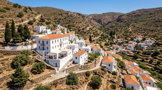
Greyton was laid out in 1854 at the foot of the Riviersonderend mountains and has kept its shape: thatched and gabled cottages, streets lined with oaks, and gravel roads that the village has repeatedly chosen not to tar, which is the clearest statement of the local ethos. It has drawn artists, retirees and weekenders from Cape Town without becoming a resort, and there is a genuine village life underneath - a Saturday market, a long-running arts festival, restaurants that close on Mondays. Behind the village the Greyton Nature Reserve runs into the mountains with walking trails, and the historic footpath over the range to McGregor is a two-day hike that walkers do in both directions. The neighbouring Moravian mission at Genadendal is a few kilometres away and predates Greyton by more than a century.
What you'll find
- The gravel streets - roads the village has chosen not to tar, under oak avenues.
- The 1854 layout - thatched and gabled cottages in the original village plan.
- The mountain reserve - trails from the edge of the village into the Riviersonderend range.
- The McGregor path - a historic two-day walking route over the mountains.
When to go
September to April. Two days. Winter brings rain and cold but green mountains.
Practical notes
Restaurants and shops keep village hours and many close early in the week. Accommodation books out for festivals. The McGregor trail is long, unmarked in places and needs a permit. It is quiet by design - people looking for nightlife will not find it.
Nearby
Genadendal is a few kilometres away; Caledon and the N2 are south.
Key facts
Source: Wikidata, item Q1003335, read on 18 October 2026.
What to pack for Greyton
Chosen from what this place is for. Tap a kit for the full checklist.
- Broken-in walking shoes or boots - Grip and ankle support matter more than looks; never hike in brand-new boots. Find on Amazon
- Comfortable walking shoes - Sightseeing means kilometres of pavement and cobbles daily. Find on Amazon
- Layers + a waterproof shell - Mountain weather turns fast; a packable rain jacket saves the day. Find on Amazon
- A slim anti-theft daypack - Zips that close properly; keep it in front in crowds and on transit. Find on Amazon
Some links on this page are Amazon affiliate links - if you buy through them we may earn a small commission at no extra cost to you.
All packing kitsPlan your trip
Where to start if Greyton is going on the list.
Booking links on this page are affiliate links - if you book through them we may earn a small commission at no extra cost to you. It never changes what we write about a place.
Opening times, ticket prices and seasonal closures change - check the official source before you go: official site.