Barberton Makhonjwa Geotrail
A mountain road through rock 3.6 billion years old, some of the oldest and best-preserved crust exposed anywhere.
Updated 1 September 2026
UNESCO World Heritage
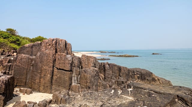
The Makhonjwa Mountains hold the Barberton Greenstone Belt, a sequence of volcanic and sedimentary rock dated to between about 3.2 and 3.6 billion years old and preserved well enough that geologists can read early Earth processes in it - meteorite impact layers, some of the oldest evidence of microbial life, and pillow lavas that formed underwater when the planet was young. It was inscribed by UNESCO in 2018. The Geotrail is a self-drive route along the road towards Eswatini with a series of marked stops, each with a panel explaining the outcrop beside it and a booklet available in Barberton. Without those panels it would be a scenic mountain road with unremarkable rock; with them it becomes readable. The town below was a gold rush settlement of the 1880s with surviving period buildings, and the road itself climbs steeply with long views.
What you'll find
- The 3.6-billion-year rock - among the oldest well-preserved crust exposed on Earth.
- The marked stops - roadside panels explaining each outcrop along the route.
- The pillow lavas - underwater volcanic forms from the young planet.
- The 2018 listing - a UNESCO site inscribed for the geology itself.
When to go
April to September. Half a day. Pick up the booklet in Barberton first.
Things to know
Without the interpretation the stops look like ordinary roadcuts - the booklet or panels are essential. Sections are steep gravel. The road continues to a border post with limited hours. There are no facilities along the route.
Nearby
Barberton's gold-rush buildings are below; Eswatini is over the Bulembu border.
What to pack for Barberton Makhonjwa Geotrail
Chosen from what this place is for. Tap a kit for the full checklist.
- Comfortable walking shoes - Sightseeing means kilometres of pavement and cobbles daily. Find on Amazon
- A slim anti-theft daypack - Zips that close properly; keep it in front in crowds and on transit. Find on Amazon
- A refillable water bottle - Many cities have public fountains; save money and plastic. Find on Amazon
- A light layer + compact umbrella - For museum air-con and a sudden shower. Find on Amazon
Some links on this page are Amazon affiliate links - if you buy through them we may earn a small commission at no extra cost to you.
All packing kitsPlan your trip
Where to start if Barberton Makhonjwa Geotrail is going on the list.
Booking links on this page are affiliate links - if you book through them we may earn a small commission at no extra cost to you. It never changes what we write about a place.
Opening times, ticket prices and seasonal closures change - check the official source before you go: official site.