Jabal Sawda
The highest point in Saudi Arabia at around 3,000 metres, on the Asir escarpment above Abha.
Updated 29 October 2026
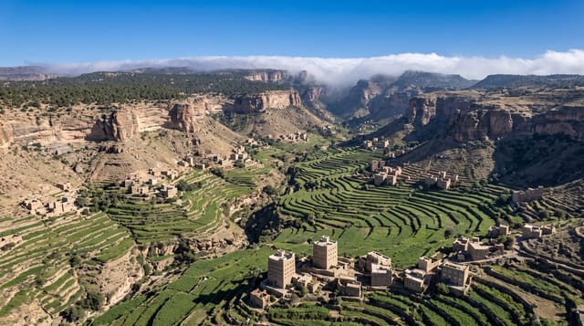
Jabal Sawda rises west of Abha to around 3,000 metres, generally cited as the highest point in Saudi Arabia, though the exact figure and the identification of the true summit have been given variously between about 2,985 and 3,015 metres. It stands on the edge of the Asir escarpment, where the ground falls away several thousand metres toward the Tihama plain in a series of terraced ridges, and the road along the top gives the viewpoints. Juniper woodland covers the slopes, thinning near the summit, and baboons are numerous along the roads. A cable car descends the escarpment from near the top, and a large tourism development, Soudah Peaks, was announced for the mountain in September 2023.
Background
Jabal Sawda, or Jabal as-Suda, is a peak in the as-Suda mountains of Saudi Arabia. The Saudi authorities officially recognise it as the country's highest point, at 3,015 metres, but a survey in 2018 measured it at 2,999 metres, a little lower than Jabal Ferwa at 3,002. The village of as-Suda lies nearby; it is a tourist centre, with a cable car to the top of the mountain. The air stays cool even in summer: at Soudah, at 2946 metres, the average high is 14.8 degrees Celsius in January and 25.9 in June.
Source: Wikipedia, "Jabal as-Sūda"
Highlights
- The summit area - the highest ground in the country on the escarpment.
- The escarpment drop - the fall toward the Tihama plain.
- Juniper woodland - the forest on the upper slopes.
- The cable car - the descent from the escarpment edge.
When to go
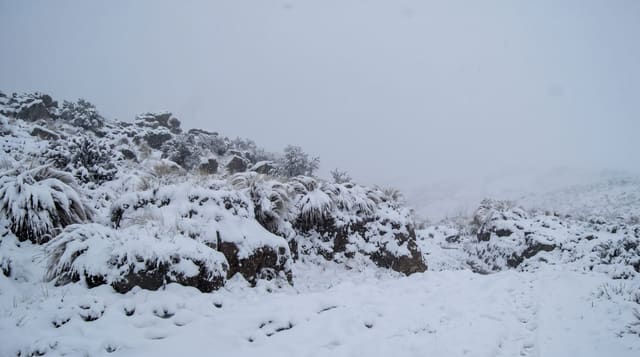
April to October for the mildest weather, which is the Saudi summer season and the busiest. Winter brings frost and occasional snow. Mist and cloud cover the summit frequently in any season.
Things to know
Cloud removes the view for long periods and the summit is often in fog. Elevation figures are quoted inconsistently. Baboons along the road are fed and aggressive. Construction for tourism development affects parts of the mountain.
Nearby
Abha lies east; the Tihama plain is far below to the west.
Key facts
Source: Wikidata, item Q1261892, read on 18 October 2026.
What to pack for Jabal Sawda
Chosen from what this place is for. Tap a kit for the full checklist.
- Broken-in walking shoes or boots - Grip and ankle support matter more than looks; never hike in brand-new boots. Find on Amazon
- Warm base layers - Merino or synthetic against the skin - never cotton, which chills when damp. Find on Amazon
- Layers for big temperature swings - Warm sun by day, near-freezing at night, even near the equator. Find on Amazon
- Layers + a waterproof shell - Mountain weather turns fast; a packable rain jacket saves the day. Find on Amazon
Some links on this page are Amazon affiliate links - if you buy through them we may earn a small commission at no extra cost to you.
All packing kitsPlan your trip
Where to start if Jabal Sawda is going on the list.
Booking links on this page are affiliate links - if you book through them we may earn a small commission at no extra cost to you. It never changes what we write about a place.
Opening times, ticket prices and seasonal closures change - check the official source before you go: official site.