Cerro Champaquí
The highest summit in the Córdoba sierras at 2,790 metres, with a small lake near the top and classic two-day walking routes from both sides.
Updated 4 September 2026

AI illustration
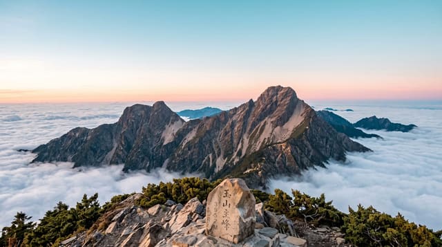
Cerro Champaquí is the roof of the Córdoba sierras, a broad granite summit at 2,790 metres with a small lake just below the top and views that on clear days reach across the province in every direction. It is the classic multi-day walk of central Argentina: routes climb from Villa Alpina in the east, from Los Molles, or up the long western flank from San Javier in Traslasierra, taking one hard day up with a night at a puesto, one of the mountain farmsteads that offer beds and meals, and a day back down. The terrain is grassland, granite slabs and streams, with weather that changes fast; snow lies on the summit in winter and storms in summer can be violent.
Highlights
- The summit and lake - the granite top at 2,790 metres with its small lagoon.
- The puestos - mountain farmsteads offering beds, meals and mules.
- The grassland ridges - long open slopes and granite slabs on the climb.
- The panorama - views across the sierras and out to the plains.
When to go
October to April for the most reliable conditions; in winter the route is cold with snow and short daylight. Summer storms build in the afternoon, so walkers start early. Weather on the summit can differ completely from the valleys.
What to expect
This is a demanding two-day walk with significant ascent, exposure and no marked infrastructure beyond the puestos; going without a guide on unfamiliar routes is unwise. Water sources are not reliable late in the season. Landowner fees are charged at several points along the trails.
Nearby
Villa Alpina and the Calamuchita valley lie east; San Javier and Traslasierra are west.
Key facts
Source: Wikidata, item Q1061148, read on 18 October 2026.
What to pack for Cerro Champaquí
Chosen from what this place is for. Tap a kit for the full checklist.
- Broken-in walking shoes or boots - Grip and ankle support matter more than looks; never hike in brand-new boots. Find on Amazon
- Reef-safe sunscreen - High SPF that will not bleach the coral you are swimming over. Find on Amazon
- Warm base layers - Merino or synthetic against the skin - never cotton, which chills when damp. Find on Amazon
- Layers for big temperature swings - Warm sun by day, near-freezing at night, even near the equator. Find on Amazon
Some links on this page are Amazon affiliate links - if you buy through them we may earn a small commission at no extra cost to you.
All packing kitsPlan your trip
Where to start if Cerro Champaquí is going on the list.
Booking links on this page are affiliate links - if you book through them we may earn a small commission at no extra cost to you. It never changes what we write about a place.
Opening times, ticket prices and seasonal closures change - check the official source before you go: official site.