Diana's Peak
The cloud-forest crown - Saint Helena's 823-metre summit ridge of tree ferns and endemics found nowhere else on Earth.
Updated 16 October 2026
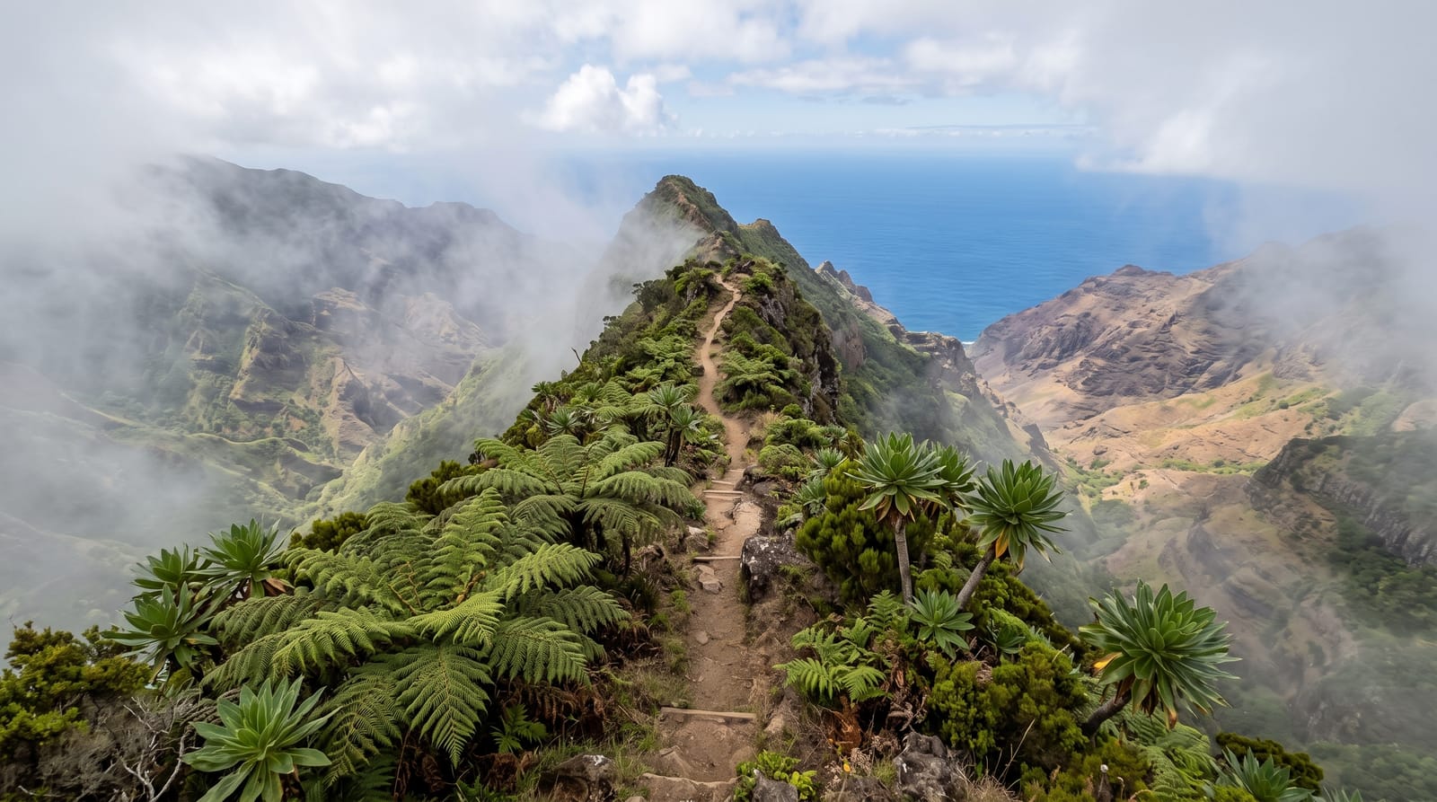
AI illustration
Saint Helena's spine rises to Diana's Peak at 823 metres, and the summit ridge keeps the island's rarest world: cloud forest of black cabbage trees and tree ferns - species that evolved here and exist nowhere else - dripping in the trade-wind mists that water a national park restored plant by plant from near-loss. The Peaks trail walks the ridge between the three summits, flax-era history and endemic gumwoods telling the island's ecological story, and clear moments open the whole South Atlantic prospect: the island's ridges falling to an ocean empty to every horizon.
Background
The peak is of volcanic origin and, at 818 metres, the highest point on Saint Helena. The mountain and its surroundings, 81 ha in all, became the island's first national park in March 1996. Its endangered endemic plants include tree fern, he cabbage, black cabbage trees and whitewood, and a nursery for endemic species sits on the northern slopes. Paths link Mt. Actaeon (814m), Diana's Peak and Cuckold's Point (815m), and large Norfolk pines crown the two lower summits. The peak marks the point where the districts of Sandy Bay, Levelwood and Longwood meet, and the nearest settlements are Bamboo Hedge, Hutt's Gate and Levelwood Village.
Source: Wikipedia, "Diana's Peak"
What's there
- The endemic cloud forest - cabbage trees and ferns of this island only.
- The Peaks ridge trail - the three-summit traverse.
- The restoration story - a flora pulled back from the brink.
- The Atlantic prospect - ocean empty to every horizon.
When to go
December to May, the island's kinder season, with mornings beating the mist that owns the ridge by afternoon; the endemics flower to their own calendars.
What to expect
Paths are steep, muddy and mist-slick by design - the cloud forest is a weather system with scenery; views are a lottery the forest itself insures against.
Nearby
The central ridges, Plantation House and Jamestown's valley.
Key facts
Source: Wikidata, item Q3376351, read on 18 October 2026.
What to pack for Diana's Peak
Chosen from what this place is for. Tap a kit for the full checklist.
- Broken-in walking shoes or boots - Grip and ankle support matter more than looks; never hike in brand-new boots. Find on Amazon
- Layers for big temperature swings - Warm sun by day, near-freezing at night, even near the equator. Find on Amazon
- Layers + a waterproof shell - Mountain weather turns fast; a packable rain jacket saves the day. Find on Amazon
- Extra-strong sun protection - Thin air means fierce UV; hat, sunglasses and high-SPF sunscreen. Find on Amazon
Some links on this page are Amazon affiliate links - if you buy through them we may earn a small commission at no extra cost to you.
All packing kitsPlan your trip
Where to start if Diana's Peak is going on the list.
Booking links on this page are affiliate links - if you book through them we may earn a small commission at no extra cost to you. It never changes what we write about a place.
Opening times, ticket prices and seasonal closures change - check the official source before you go: official site.
Keep exploring



← More nature & outdoors in Saint Helena, Ascension and Tristan da Cunha