Saint-Barthélemy Nature Reserve
A marine reserve in five zones around the island, created in 1996.
Updated 22 October 2026
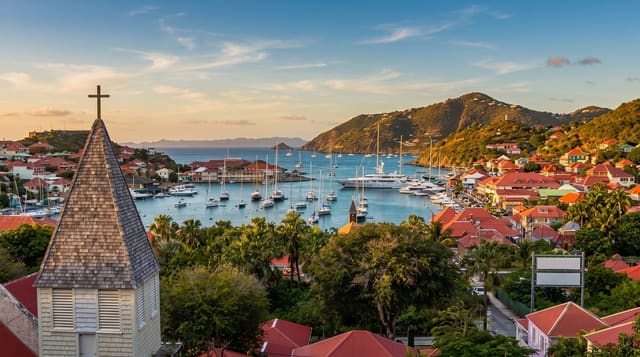
The nature reserve was created in 1996 and covers marine ground in five separate zones around Saint Barthelemy, taking in reef, sea grass beds and the waters around several of the offshore islets. Anchoring and fishing are restricted inside it. Turtles, rays and reef fish are what most visitors see, and the islets carry seabird colonies that are the reason some of the zones exist. Management sits with the collectivity, and the zones are marked on charts used by boat operators.
History
Founded in 1996, the reserve covers 1,200 hectares in five sectors: Gros Îlets and Pain de Sucre off Gustavia harbour, the waters round the islets Fourchue, Frégate and Île Toc Vers, and part of Colombier bay, all marked on nautical charts (Wikipedia, Nature Reserve of Saint Barthélemy).
The landscape
- The five zones - separate protected areas around the island.
- The sea grass beds - the ground turtles feed on.
- The offshore islets - the rocks and their seabird colonies.
- The reef - the coral inside the protected water.
When to go
December to April is the dry high season and conditions are best. Visibility varies with the swell. June to November is the hurricane season.
Good to know
Reef condition here has suffered from storms and bleaching. Access is through operators; most of the reserve cannot be reached from shore. Anchoring and fishing rules apply and are enforced.
Nearby
Fourchue Island is northwest, and Gustavia is south.
Key facts
Source: Wikidata, item Q15632531, read on 18 October 2026.
What to pack for Saint-Barthélemy Nature Reserve
Chosen from what this place is for. Tap a kit for the full checklist.
- Broken-in walking shoes or boots - Grip and ankle support matter more than looks; never hike in brand-new boots. Find on Amazon
- Travel rod + reel - A packable multi-piece rod fits in a case and covers most holiday fishing. Find on Amazon
- Binoculars - The single best wildlife tool - even a compact pair transforms a sighting. Find on Amazon
- Layers + a waterproof shell - Mountain weather turns fast; a packable rain jacket saves the day. Find on Amazon
Some links on this page are Amazon affiliate links - if you buy through them we may earn a small commission at no extra cost to you.
All packing kitsPlan your trip
Where to start if Saint-Barthélemy Nature Reserve is going on the list.
Booking links on this page are affiliate links - if you book through them we may earn a small commission at no extra cost to you. It never changes what we write about a place.
Opening times, ticket prices and seasonal closures change - check the official source before you go: official site.