Morne du Vitet
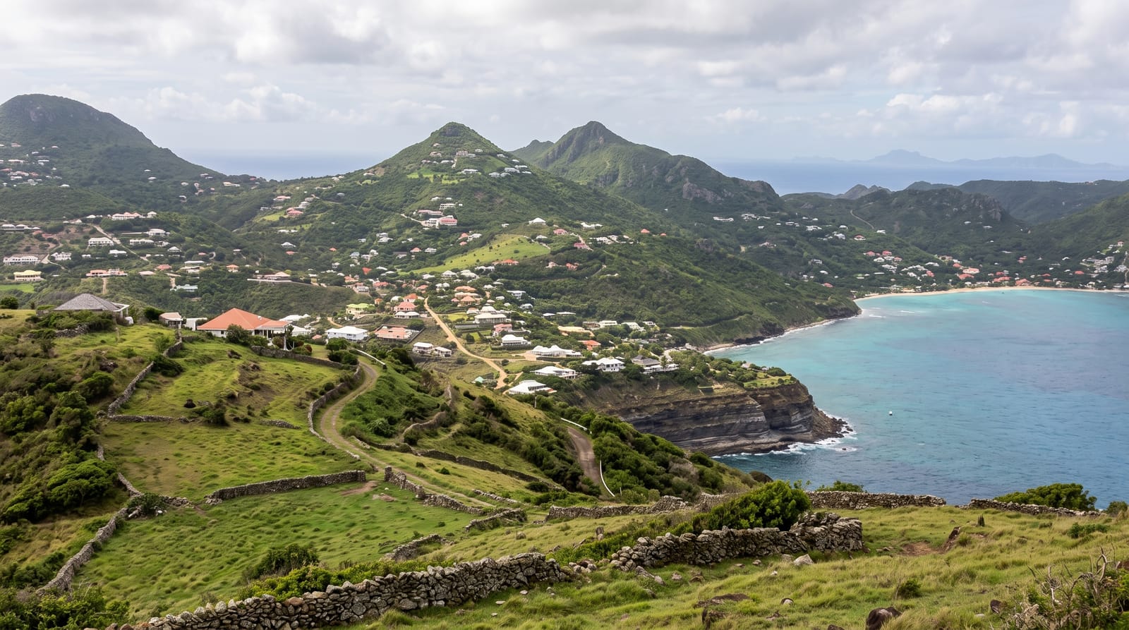
The island's green roof - pasture lanes and stone walls climbing to 286 metres, with the lagoon-and-villa map unrolled below.
Updated 21 October 2026
AI illustration
St Barts's highest ground rises green and rural: Morne du Vitet's 286 metres climb through cattle pastures seamed with old stone walls - the island's surviving countryside - on lanes where the walking is easy and the reward cartographic: Grand Cul-de-Sac's lagoon turquoise below, Saint-Jean's runway theatre westward, Toiny's wild coast south, and the villa-roofed ridges arranged like a scale model. Goats supervise, trade winds ventilate, and the summit's ordinariness - grass, wall, view - is the island's rarest luxury. The gentler eastern and northern slopes are settled, while the steep southern face drops to the sea within about four hundred metres. The road up is narrow and steep, and the last part is better walked than driven.
What you'll find
- The summit map - lagoons, runway and ridges below.
- The stone-wall pastures - the island's rural survival.
- Grand Cul-de-Sac's turquoise - the lagoon at your feet.
- The trade-wind walking - easy lanes in constant ventilation.
When to go
December to May with the season; mornings offer the clearest horizons and coolest lanes.
Good to know
Paths thread private pasture edges - gates closed, greetings given; the summit is a viewpoint stroll, not a hike, which is its charm.
Nearby
Grand Cul-de-Sac, Toiny's coast and Saint-Jean.
Key facts
Source: Wikidata, item Q3055081, read on 18 October 2026.
What to pack for Morne du Vitet
Chosen from what this place is for. Tap a kit for the full checklist.
- Broken-in walking shoes or boots - Grip and ankle support matter more than looks; never hike in brand-new boots. Find on Amazon
- Reef-safe sunscreen - High SPF that will not bleach the coral you are swimming over. Find on Amazon
- Spare batteries + cards - Cold and long shoots drain power; never run out at the good light. Find on Amazon
- Layers + a waterproof shell - Mountain weather turns fast; a packable rain jacket saves the day. Find on Amazon
Some links on this page are Amazon affiliate links - if you buy through them we may earn a small commission at no extra cost to you.
All packing kitsPlan your trip
Where to start if Morne du Vitet is going on the list.
Booking links on this page are affiliate links - if you book through them we may earn a small commission at no extra cost to you. It never changes what we write about a place.
Opening times, ticket prices and seasonal closures change - check the official source before you go: official site.