Rusumo Falls
A broad fall on the Kagera river at the Tanzanian border, where the water forces through a narrow rock gap.
Updated 16 October 2026
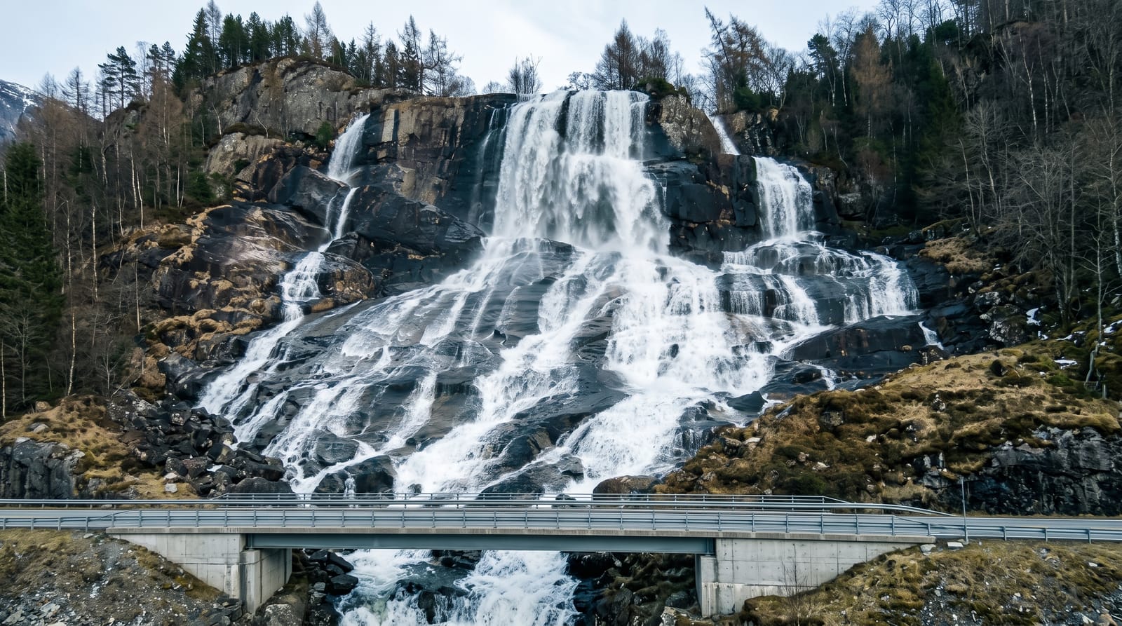
At Rusumo the Kagera river, one of the headwaters of the Nile, is squeezed through a narrow gap in the rock and drops in a broad brown fall, powerful rather than tall. The border bridge crosses immediately above it, which is where visitors look down from. A hydroelectric scheme built jointly by Rwanda, Tanzania and Burundi now takes water from the river here, which has changed the flow.
Background
The falls drop approximately 15 m (49 ft) and spread about 40 m (130 ft) across, over a bed of Precambrian schists and quartz-phyllites. The Kagera here belongs to the most distant headwaters of the Nile. Modest in height, the site still mattered in the history of Rwanda, because it offered the only place to bridge the river in that area. The Regional Rusumo Falls Hydropower Project won funding approval from the African Development Bank Group in 2024. It pairs an 80 MW generating plant with transmission lines and substations, adding renewable power and electricity access in Tanzania, Rwanda and Burundi.
Source: Wikipedia, "Rusumo Falls"
What you'll find
- The falls - the Kagera forced through a rock gap and dropping in a broad sheet.
- The bridge view - the crossing directly above the fall.
- The Kagera - one of the furthest headwaters of the Nile system.
- The hydro scheme - the regional power project built on the river here.
When to go
March to May and September to November, the rainy seasons, give the strongest flow. The dry months and the hydro abstraction reduce it. Mornings are the best light.
What to expect
This is an active border post and photography near the crossing is restricted; asking before taking pictures matters. The hydro scheme has reduced the flow from what older photographs show. There are no visitor facilities.
Nearby
Kibungo is northwest, and Akagera National Park is north.
Key facts
Source: Wikidata, item Q959903, read on 18 October 2026.
What to pack for Rusumo Falls
Chosen from what this place is for. Tap a kit for the full checklist.
- Broken-in walking shoes or boots - Grip and ankle support matter more than looks; never hike in brand-new boots. Find on Amazon
- Layers + a waterproof shell - Mountain weather turns fast; a packable rain jacket saves the day. Find on Amazon
- Daypack with rain cover - 20-30 litres holds water, snacks, layers and a first-aid kit. Find on Amazon
- Offline maps + a power bank - Download the trail before you lose signal; carry backup charge. Find on Amazon
Some links on this page are Amazon affiliate links - if you buy through them we may earn a small commission at no extra cost to you.
All packing kitsPlan your trip
Where to start if Rusumo Falls is going on the list.
Booking links on this page are affiliate links - if you book through them we may earn a small commission at no extra cost to you. It never changes what we write about a place.
Opening times, ticket prices and seasonal closures change - check the official source before you go: official site.