Cordillera Azul National Park
Some 1.35 million hectares of forested ridges between the Andes and the Amazon, with no roads and no visitor infrastructure.
Updated 18 October 2026
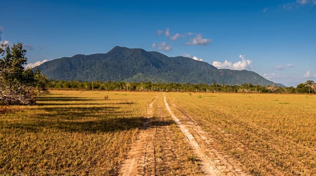
Cordillera Azul covers about 1.35 million hectares of the last unbroken mountain forest between the Andes proper and the Amazon lowlands, a block of parallel ridges and enclosed valleys that was surveyed in a rapid biological inventory in 2000 and declared a national park the following year on the strength of what was found - dozens of species new to science within weeks, entire valleys with no evidence of human use, and habitats isolated from the surrounding lowlands for long enough to develop their own species. There is no road into it and no tourism programme. The park is managed under an agreement with CIMA, a Peruvian conservation organisation, working with the communities in the buffer zone, and much of the effort goes into controlling incursion for logging, coca and settlement along the edges. Travellers see it from the Tarapoto to Tingo María highway, which crosses the buffer zone through steep forested country.
History
In 1963 the Biavo-Cordillera Azul National Forest was created over 2,178,000 hectares, and in 1997 it was declared a forest for timber production, open to logging. In 1999 research by Red Ambiental Peruana, an alliance of NGOs, and COPRI, the authority for timber rights, led to agreement to protect the forest's highly biodiverse north; the Cordillera Azul Reserved Zone was set up in 2000, a Field Museum team assessed its wildlife, and on the recommendation of the Ministry of Agriculture the national park was created in 2001 (Wikipedia, Cordillera Azul National Park).
The landscape
- The ridges - parallel forested mountains between the Andes and the lowlands.
- The 2000 inventory - the rapid survey that found new species within weeks.
- The scale - about 1.35 million hectares with no roads through it.
- The highway view - the Tarapoto to Tingo María road crossing the buffer zone.
When to go
There is no visitor programme; the park interior is closed to general tourism. The highway crossing is passable year-round, better May to September.
Things to know
This is not a destination - there are no trails, guides or facilities for visitors, and entry requires research permits. What you can see is forested country from a road. Treat any operator offering trips inside with scepticism.
Nearby
Tarapoto is north-east; Tingo María and the Huallaga are south-west.
Key facts
Source: Wikidata, item Q264948, read on 18 October 2026.
What to pack for Cordillera Azul National Park
Chosen from what this place is for. Tap a kit for the full checklist.
- Broken-in walking shoes or boots - Grip and ankle support matter more than looks; never hike in brand-new boots. Find on Amazon
- Binoculars - The single best wildlife tool - even a compact pair transforms a sighting. Find on Amazon
- Layers + a waterproof shell - Mountain weather turns fast; a packable rain jacket saves the day. Find on Amazon
- A zoom camera or long lens - Animals rarely come close; reach beats megapixels. Find on Amazon
Some links on this page are Amazon affiliate links - if you buy through them we may earn a small commission at no extra cost to you.
All packing kitsPlan your trip
Where to start if Cordillera Azul National Park is going on the list.
Booking links on this page are affiliate links - if you book through them we may earn a small commission at no extra cost to you. It never changes what we write about a place.
Opening times, ticket prices and seasonal closures change - check the official source before you go: official site.