Ryten
A 543-metre Lofoten peak with an overhanging ledge above Kvalvika, the source of one of Norway's most copied photographs.
Updated 4 September 2026
AI illustration
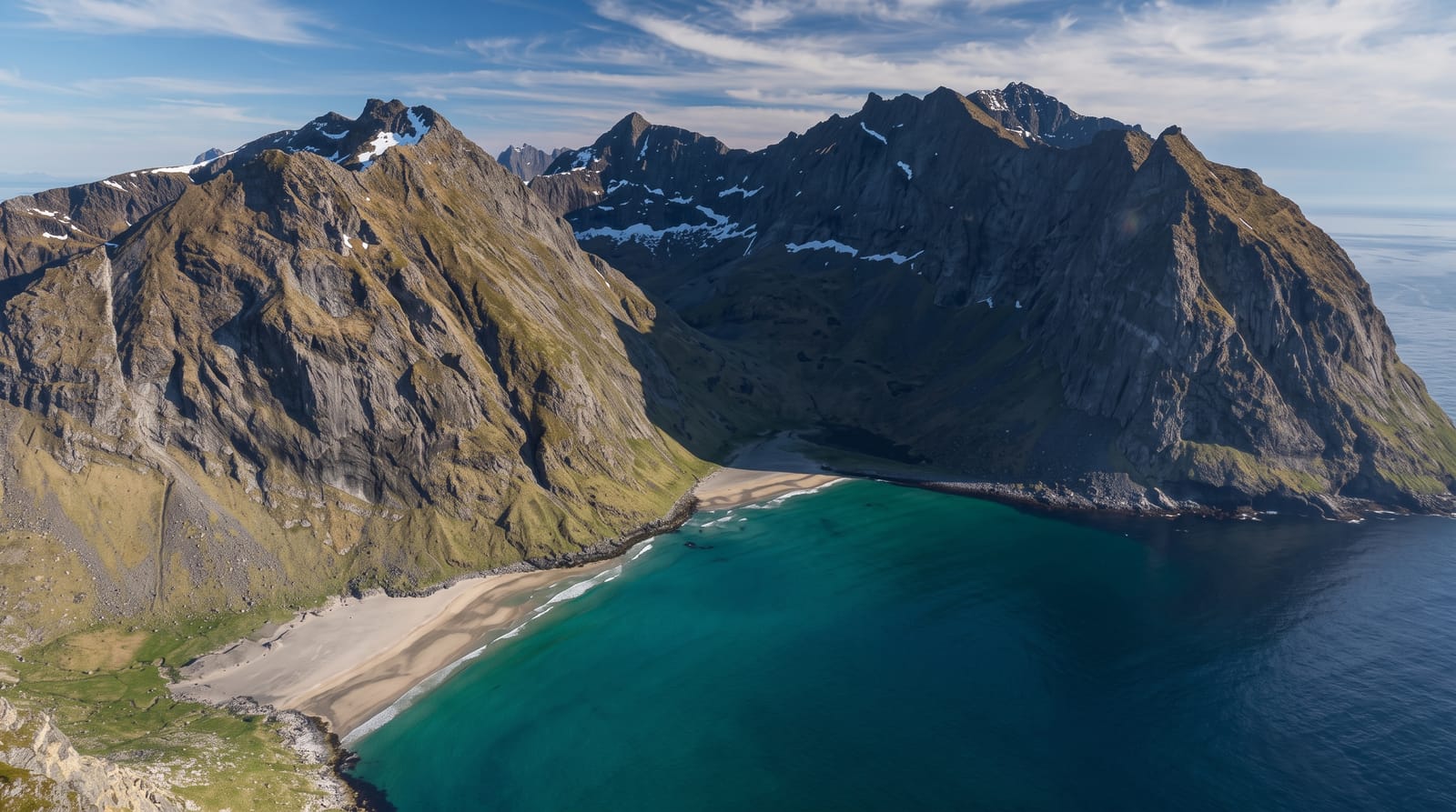
Ryten rises to 543 metres above Kvalvika beach, and the walk up from Fredvang takes about two hours on a path that climbs a boggy slope to a broad summit ridge. Just below the top, a slab of rock projects over the drop with the whole bay and the Atlantic behind it, and photographs taken sitting on that ledge have circulated so widely that a queue forms on summer afternoons. The view itself is genuine and does not need the ledge: the beach, the outer coast, and in clear weather the mountains of Vestvagoy and the open sea. Many walkers combine Ryten with a descent to Kvalvika, making a loop of five hours or more.
What you'll find
- The cliff ledge - the projecting slab above the drop to the beach.
- The Kvalvika view - the full bay and Atlantic coast from above.
- The summit ridge - broad open ground with views in all directions.
- The Kvalvika loop - a combined route down to the beach and back.
When to go
June to September for a clear path and long daylight; the midnight sun makes evening ascents possible in June and July, which also avoids the queue at the ledge. Winter needs spikes and experience.
Practical notes
The path is wet and boggy for much of its length and rocky near the top. The famous ledge sits above a lethal drop with no protection, and people take risks there for photographs. Parking at Fredvang is small, charged and fills early.
Nearby
Kvalvika beach lies below; Fredvang, Ramberg and Reine are on the road side of the island.
Key facts
Source: Wikidata, item Q31657540, read on 18 October 2026.
What to pack for Ryten
Chosen from what this place is for. Tap a kit for the full checklist.
- Broken-in walking shoes or boots - Grip and ankle support matter more than looks; never hike in brand-new boots. Find on Amazon
- Spare batteries + cards - Cold and long shoots drain power; never run out at the good light. Find on Amazon
- Warm base layers - Merino or synthetic against the skin - never cotton, which chills when damp. Find on Amazon
- Layers for big temperature swings - Warm sun by day, near-freezing at night, even near the equator. Find on Amazon
Some links on this page are Amazon affiliate links - if you buy through them we may earn a small commission at no extra cost to you.
All packing kitsPlan your trip
Where to start if Ryten is going on the list.
Booking links on this page are affiliate links - if you book through them we may earn a small commission at no extra cost to you. It never changes what we write about a place.
Opening times, ticket prices and seasonal closures change - check the official source before you go: official site.