Femundsmarka National Park
A wilderness of pine forest, lakes and glacial boulders on the Swedish border, best crossed by canoe.
Updated 4 September 2026
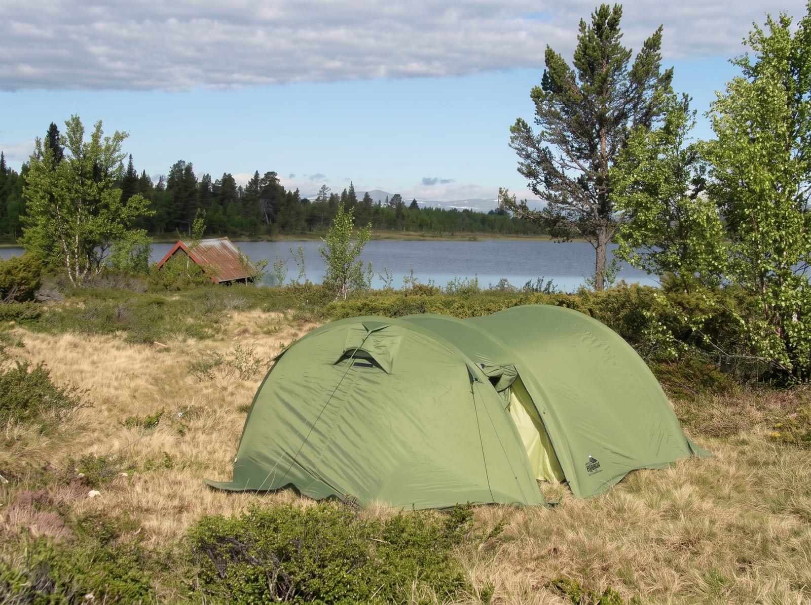
AI illustration
Femundsmarka covers about six hundred square kilometres east of Lake Femund on the Swedish border, and it is a different Norway from the fjords: flat to gently rolling, covered in old pine forest and bog, scattered with thousands of lakes and with glacial boulders left standing on bare rock. Musk ox occasionally wander in from Dovre and a herd of wild horses grazes in the north. The classic way through is by canoe, portaging between lakes on routes used for centuries, with self-service cabins along the way; the historic boat Fæmund II crosses the lake and drops walkers and paddlers at the jetties. Roros, the old copper-mining town on the UNESCO list, is the usual gateway.
What you'll find
- The lake chains - canoe routes linked by portages between waters.
- The old pine forest - ancient trees on dry glacial ground.
- The erratic boulders - large stones left standing by the retreating ice.
- The Fæmund II - a historic passenger boat serving the lake jetties.
When to go
July to September for paddling and walking, once the ice has gone and before the autumn storms; the boat runs in the same window. Winter is a ski-touring landscape with very few people.
What to expect
This is genuine wilderness with no marked services inside, no phone signal in much of it and long distances between cabins. Mosquitoes and horseflies in July are severe. Canoe portages are hard work, and weather on the big lakes can make paddling dangerous.
Nearby
Roros, the UNESCO mining town, lies northwest; Lake Femund and the Swedish border are alongside.
Key facts
Source: Wikidata, item Q1404574, read on 18 October 2026.
What to pack for Femundsmarka National Park
Chosen from what this place is for. Tap a kit for the full checklist.
- Broken-in walking shoes or boots - Grip and ankle support matter more than looks; never hike in brand-new boots. Find on Amazon
- Quick-dry clothing - Board shorts or synthetics that shrug off spray and dry fast. Find on Amazon
- Binoculars - The single best wildlife tool - even a compact pair transforms a sighting. Find on Amazon
- Layers + a waterproof shell - Mountain weather turns fast; a packable rain jacket saves the day. Find on Amazon
Some links on this page are Amazon affiliate links - if you buy through them we may earn a small commission at no extra cost to you.
All packing kitsPlan your trip
Where to start if Femundsmarka National Park is going on the list.
Booking links on this page are affiliate links - if you book through them we may earn a small commission at no extra cost to you. It never changes what we write about a place.
Opening times, ticket prices and seasonal closures change - check the official source before you go: official site.