Dronningruta
A ridge-and-coast loop between two Vesteralen villages, named after a queen who walked it in 1994.
Updated 12 October 2026
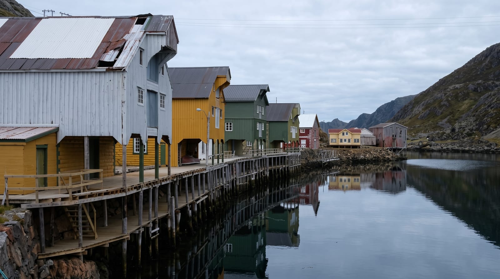
The Queen's Route links the villages of Nyksund and Sto on the outer coast of Langoya, about fifteen kilometres in a loop: one leg climbs over the ridge with the sea on both sides and the Vesteralen coast opening out, the other follows the shoreline back at sea level past coves and boulder beaches. It takes its name from Queen Sonja, who walked it in 1994 and has returned since, and it has become the best-known day walk in Vesteralen. Nyksund at one end is a story of its own: a fishing village abandoned in the 1970s when the harbour proved too small for modern boats, then gradually resettled from the 1980s by artists and incomers, with buildings restored around a still-visible ruin.
What's there
- The ridge leg - a high crossing with sea views on both sides.
- The coastal leg - a shoreline return past coves and boulder beaches.
- Nyksund - an abandoned fishing village partly resettled since the 1980s.
- The outer coast - open Atlantic and the Vesteralen islands beyond.
When to go
June to September, when the route is clear of snow and the midnight sun extends the day; June and July give continuous daylight. The ridge is exposed and should be avoided in strong wind or fog.
Before you go
The full loop is a long day with a steep climb, and the coastal section is slow going over boulders. There is no shelter and no water on the ridge. The route can be shortened by walking one way and arranging a lift back.
Nearby
Sto and Myre are on the same peninsula; Andenes and the Vesteralen ferries lie north.
What to pack for Dronningruta
Chosen from what this place is for. Tap a kit for the full checklist.
- Broken-in walking shoes or boots - Grip and ankle support matter more than looks; never hike in brand-new boots. Find on Amazon
- Travel rod + reel - A packable multi-piece rod fits in a case and covers most holiday fishing. Find on Amazon
- Reef-safe sunscreen - High SPF that will not bleach the coral you are swimming over. Find on Amazon
- Spare batteries + cards - Cold and long shoots drain power; never run out at the good light. Find on Amazon
Some links on this page are Amazon affiliate links - if you buy through them we may earn a small commission at no extra cost to you.
All packing kitsPlan your trip
Where to start if Dronningruta is going on the list.
Booking links on this page are affiliate links - if you book through them we may earn a small commission at no extra cost to you. It never changes what we write about a place.
Opening times, ticket prices and seasonal closures change - check the official source before you go: official site.