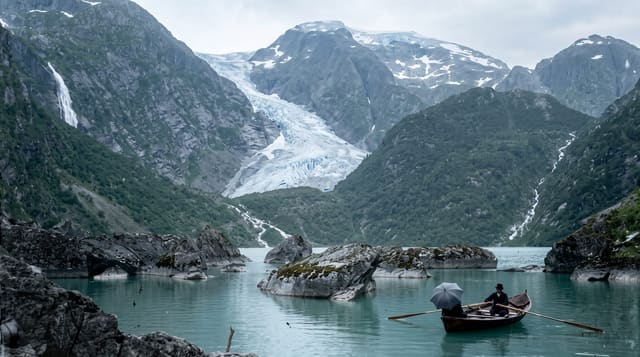
Buarbreen
An arm of the Folgefonna glacier above Odda, reached by a steep scramble up a boulder valley with chains fixed on the rock.
Updated 21 October 2026

AI illustration
Buarbreen descends from the Folgefonna ice cap into the Buerdalen valley south of Odda, and the walk to its foot is short in distance but demanding in character: about two hours from the farm at Buer, crossing a river on a suspension bridge, then climbing over moraine and large boulders with chains and ropes fixed at the steeper rock steps. The reward is standing close under a blue calving front with the meltwater river coming out beneath it. Like the other Folgefonna arms it has retreated substantially, and the bare rock between the current front and the older moraines shows how far. Signs at the site warn against approaching the ice, and the warning is serious: blocks fall regularly.
What you'll find
- The blue ice front - a calving glacier face at the head of the valley.
- The chain sections - fixed ropes and chains on the steep rock steps.
- The boulder field - moraine left by the retreating glacier.
- The meltwater river - the outflow crossed by a suspension bridge.
When to go
July to September, once snow has cleared from the upper valley; earlier the boulder field is treacherous. Clear weather is important, both for the view and because wet rock on the chained sections is slippery.
Before you go
This is a scramble rather than a walk, with hands needed in places and real fall risk on wet rock. Do not go under or onto the ice, where blocks collapse without warning. Parking at Buer farm is private with a fee, and the last road section is narrow.
Nearby
Odda and the Trolltunga trailhead are at the head of the Sorfjord; Bondhusvatnet lies on the other side of Folgefonna.
Key facts
Source: Wikidata, item Q997354, read on 18 October 2026.
What to pack for Buarbreen
Chosen from what this place is for. Tap a kit for the full checklist.
- Broken-in walking shoes or boots - Grip and ankle support matter more than looks; never hike in brand-new boots. Find on Amazon
- Warm base layers - Merino or synthetic against the skin - never cotton, which chills when damp. Find on Amazon
- Layers + a waterproof shell - Mountain weather turns fast; a packable rain jacket saves the day. Find on Amazon
- An insulated + windproof jacket - A down or synthetic layer under a hard shell handles most cold. Find on Amazon
Some links on this page are Amazon affiliate links - if you buy through them we may earn a small commission at no extra cost to you.
All packing kitsPlan your trip
Where to start if Buarbreen is going on the list.
Booking links on this page are affiliate links - if you book through them we may earn a small commission at no extra cost to you. It never changes what we write about a place.
Opening times, ticket prices and seasonal closures change - check the official source before you go: official site.