Arendal
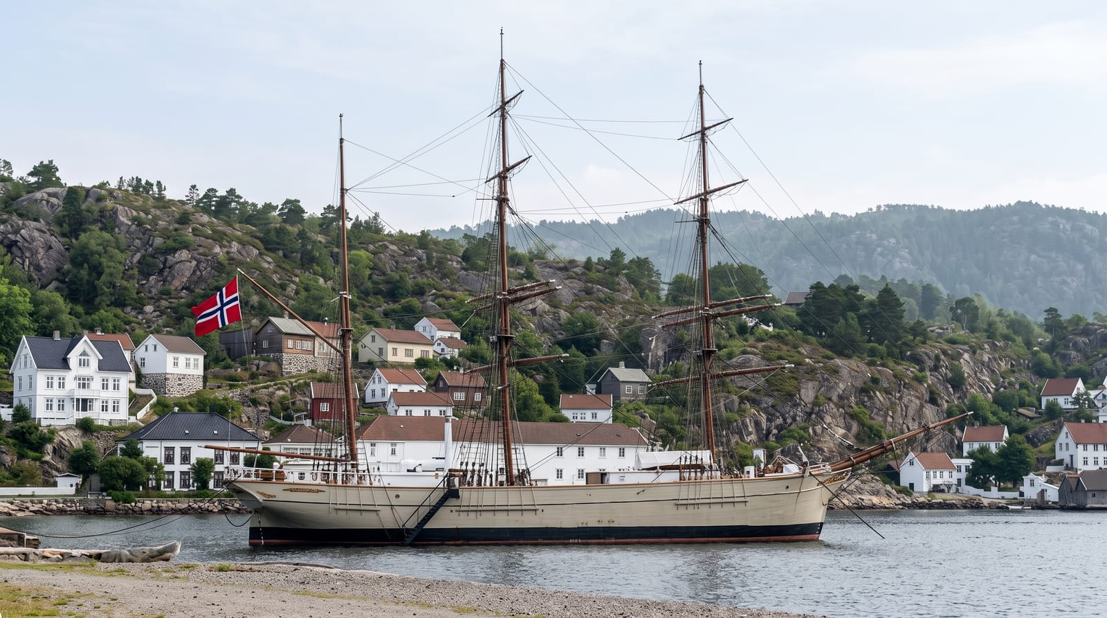
A southern harbour town built on islands and canals, with a preserved wooden quarter on the Tyholmen headland.
Updated 21 October 2026
AI illustration
Arendal was the largest shipping town in Norway in the nineteenth century, with a fleet bigger than any other port, and it was built partly on water: canals ran between the islands and the town was called the Venice of the north until the channels were filled in the twentieth century. Tyholmen, the headland by the harbour, survived the fires and holds a dense quarter of white timber houses from the 1700s and 1800s, protected and awarded for its conservation. The Pollen basin in the centre is lined with restaurants and fills with boats in summer. Small ferries run to Merdo, Tromoy and the skerries of Raet National Park. Each August the town hosts Arendalsuka, Norway's main political gathering.
History
The village of Arendal grew up in the mid-16th century at the mouth of the Nidelva, where timber floated down from the inland forests was shipped out, and in 1610 it became a ladested, a loading port with trading rights. It received full town privileges on 1 May 1723, and in 1880 it was the country's biggest port by tonnage handled (Wikipedia, Arendal (town)).
The main sights
- Tyholmen - a protected quarter of eighteenth and nineteenth-century timber houses.
- The Pollen basin - the central harbour lined with restaurants.
- The island ferries - boats to Merdo, Tromoy and the outer skerries.
- The shipping history - a town built by the largest merchant fleet in Norway.
When to go
June to August for the harbour at its liveliest and full ferry schedules; Arendalsuka in August fills every hotel in the region. Winter is quiet with reduced services.
Before you go
July crowds the harbour and the island boats. Accommodation is impossible to find during Arendalsuka without booking far ahead. The canals that gave the town its nickname no longer exist.
Nearby
Raet National Park and its islands lie offshore; Grimstad and Risor are along the coast.
Key facts
Source: Wikidata, item Q2699921, read on 18 October 2026.
What to pack for Arendal
Chosen from what this place is for. Tap a kit for the full checklist.
- Comfortable walking shoes - Sightseeing means kilometres of pavement and cobbles daily. Find on Amazon
- A slim anti-theft daypack - Zips that close properly; keep it in front in crowds and on transit. Find on Amazon
- A refillable water bottle - Many cities have public fountains; save money and plastic. Find on Amazon
- A light layer + compact umbrella - For museum air-con and a sudden shower. Find on Amazon
Some links on this page are Amazon affiliate links - if you buy through them we may earn a small commission at no extra cost to you.
All packing kitsPlan your trip
Where to start if Arendal is going on the list.
Booking links on this page are affiliate links - if you book through them we may earn a small commission at no extra cost to you. It never changes what we write about a place.
Opening times, ticket prices and seasonal closures change - check the official source before you go: official site.