Cerro Mogotón
Nicaragua's highest point at 2,107 metres, a pine-forest climb on the Honduran border near Ocotal.
Updated 31 August 2026
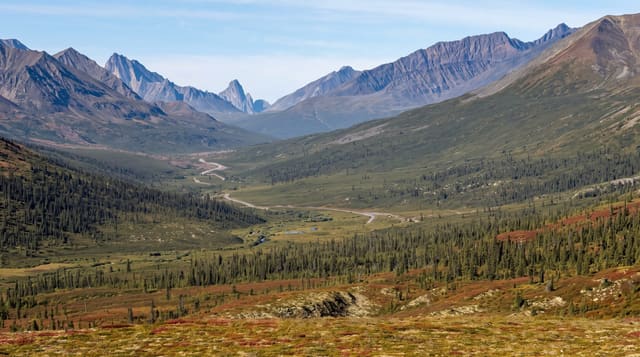
Mogotón reaches 2,107 metres in the Dipilto y Jalapa range on the Honduran frontier, making it the highest point in Nicaragua, and the country around it is unlike the volcanic west: granite hills covered in pine and oak, cool air, and coffee farms on the lower slopes producing some of the country's best beans. The climb takes five to seven hours return from the trailhead above Dipilto, through coffee and then pine forest to a summit that is wooded and gives only partial views, which is worth knowing before setting out. Community guides from Dipilto lead the route, which is required both for navigation and because the border runs close to the top. Orchids and highland birds are found along the way.
What's there
- Pine and oak forest - highland woodland unlike the volcanic west.
- Coffee farms - the Dipilto plantations on the lower slopes.
- The summit marker - the highest point in the country, wooded over.
- Highland birds and orchids - the flora and fauna of the range.
When to go
December to April for the trail; the range is cool and often misty. The rainy season makes the route muddy and the views nonexistent. Coffee harvest around December to February adds interest on the approach.
What to expect
The summit is forested and the view is limited, which disappoints people expecting a panorama from the country's high point. The climb is long, five to seven hours return. A guide is required and the border proximity means staying on the route matters. Facilities are none.
Nearby
Ocotal lies south; Ciudad Antigua is southeast.
Key facts
Source: Wikidata, item Q2092378, read on 18 October 2026.
What to pack for Cerro Mogotón
Chosen from what this place is for. Tap a kit for the full checklist.
- Broken-in walking shoes or boots - Grip and ankle support matter more than looks; never hike in brand-new boots. Find on Amazon
- Layers for big temperature swings - Warm sun by day, near-freezing at night, even near the equator. Find on Amazon
- Layers + a waterproof shell - Mountain weather turns fast; a packable rain jacket saves the day. Find on Amazon
- Extra-strong sun protection - Thin air means fierce UV; hat, sunglasses and high-SPF sunscreen. Find on Amazon
Some links on this page are Amazon affiliate links - if you buy through them we may earn a small commission at no extra cost to you.
All packing kitsPlan your trip
Where to start if Cerro Mogotón is going on the list.
Booking links on this page are affiliate links - if you book through them we may earn a small commission at no extra cost to you. It never changes what we write about a place.
Opening times, ticket prices and seasonal closures change - check the official source before you go: official site.