Mount Hutt
Canterbury's largest ski field, high, exposed, and reached by a steep unsealed access road that closes often.
Updated 28 August 2026
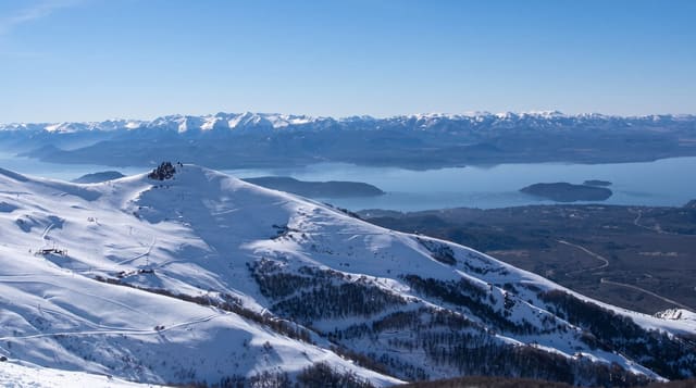
Mount Hutt runs from about 1,400 to 2,086 metres on the eastern edge of the Southern Alps, which gives it one of the longest seasons in the country - usually mid-June into October - and a view straight out over the braided Rakaia River and the Canterbury Plains that is unlike any other field here. The terrain covers beginner areas through to steep chutes off the summit. The complication is access: the ski road climbs about 800 metres of unsealed switchbacks with no barrier on the drop side, chains are frequently compulsory, and the mountain closes for wind more than most - it is exposed enough that lifts stop on days that would be skiable elsewhere. Check the road and mountain status before leaving Methven, every time. Most people stay in Methven rather than Christchurch and drive up each morning.
The main sights
- The terrain - beginner slopes to steep summit chutes, 1,400 to 2,086 metres.
- The plains view - the Rakaia River and Canterbury Plains below.
- The long season - mid-June into October, among the longest here.
- The access road - 800 metres of unsealed switchbacks.
When to go
June to October. Check the road and wind status daily before driving up. Weekends draw Christchurch traffic; midweek is quieter.
Things to know
Wind closures are frequent and can happen with no warning. The access road is genuinely intimidating - gravel, steep, unbarriered - and chains are often required. No accommodation on the mountain.
Nearby
Methven is the base town; the Rakaia Gorge is close.
Key facts
Source: Wikidata, item Q692322, read on 18 October 2026.
What to pack for Mount Hutt
Chosen from what this place is for. Tap a kit for the full checklist.
- Comfortable walking shoes - Sightseeing means kilometres of pavement and cobbles daily. Find on Amazon
- A slim anti-theft daypack - Zips that close properly; keep it in front in crowds and on transit. Find on Amazon
- A refillable water bottle - Many cities have public fountains; save money and plastic. Find on Amazon
- A light layer + compact umbrella - For museum air-con and a sudden shower. Find on Amazon
Some links on this page are Amazon affiliate links - if you buy through them we may earn a small commission at no extra cost to you.
All packing kitsPlan your trip
Where to start if Mount Hutt is going on the list.
Booking links on this page are affiliate links - if you book through them we may earn a small commission at no extra cost to you. It never changes what we write about a place.
Opening times, ticket prices and seasonal closures change - check the official source before you go: official site.