Lake Hawea
A deep blue glacial lake separated from Wanaka by a narrow neck of land, raised twenty metres for hydro.
Updated 27 August 2026
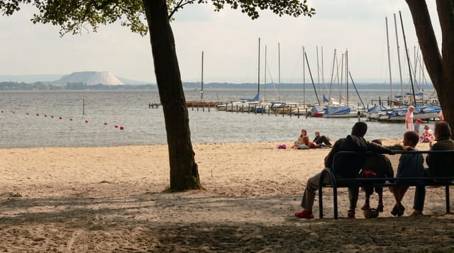
Hawea is about 141 square kilometres in area, over three hundred metres deep, and separated from Lake Wanaka by The Neck - a strip of land only about a kilometre wide where the two lakes almost meet, with a lookout on the highway giving both at once. Its colour is a deeper, more saturated blue than Wanaka's, and it is walled by steep mountains on the western side. The lake was raised about twenty metres in 1958 as part of the Clutha hydro scheme, which is why the shoreline has that bare gravel margin and why dead trees still stand in shallow water in places - it is not a natural level. Hawea township at the southern end has a beach, a campground and a store; the road north along the eastern shore continues to Makarora and the Haast Pass. The water is cold enough that swimming is brief, and the lake is used for fishing and boating.
The landscape
- The Neck - the kilometre-wide strip between Hawea and Wanaka.
- The deep blue - a more saturated colour than neighbouring Wanaka.
- The raised shoreline - the bare margin left by the 1958 hydro lift.
- The mountain wall - steep slopes along the western side.
When to go
October to April. Mornings are calm; afternoon wind gets up on the lake. The Neck lookout works at any time and is a two-minute stop.
What to expect
The water is very cold year round. The raised shoreline is bare and gravelly rather than scenic up close. Hawea township is small with limited services. Wind builds through the afternoon.
Nearby
Wanaka is south; Makarora and the Haast Pass are north.
Key facts
Source: Wikidata, item Q1440634, read on 18 October 2026.
What to pack for Lake Hawea
Chosen from what this place is for. Tap a kit for the full checklist.
- Travel rod + reel - A packable multi-piece rod fits in a case and covers most holiday fishing. Find on Amazon
- Reef-safe sunscreen - High SPF that will not bleach the coral you are swimming over. Find on Amazon
- A small tackle selection - Hooks, weights, line and a few lures or flies suited to local waters. Find on Amazon
- Quick-dry towel - A microfibre towel packs small and dries in minutes. Find on Amazon
Some links on this page are Amazon affiliate links - if you buy through them we may earn a small commission at no extra cost to you.
All packing kitsPlan your trip
Where to start if Lake Hawea is going on the list.
Booking links on this page are affiliate links - if you book through them we may earn a small commission at no extra cost to you. It never changes what we write about a place.
Opening times, ticket prices and seasonal closures change - check the official source before you go: official site.