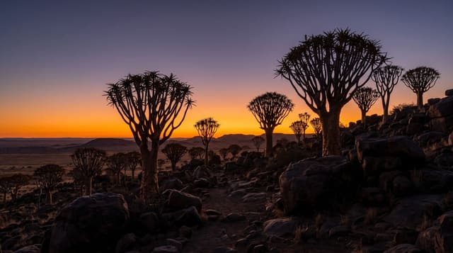
Brukkaros Mountain
An extinct volcanic structure rising six hundred metres over the southern plains, with a crater you can walk into.
Updated 21 October 2026
Brukkaros rises about six hundred and fifty metres above the plains north of Keetmanshoop, a near-circular structure formed around eighty million years ago when rising magma met groundwater and blew out a crater, later eroded into the shape it has now. A track climbs partway up the outer slope and a footpath continues into the crater, which is wide and floored with scrub. A solar observatory ran near the rim from 1926 to 1931 and its ruins remain.
History
The Nama call the mountain Geitsi Gubib, after the long leather apron worn by Khoikhoi women, known in Afrikaans as broek-en-karos, which became the German Brukkaros. From 1926 to 1931 the National Geographic Society and the Smithsonian Institution ran a solar observatory on the mountain to measure daily solar radiation (Wikipedia, Brukkaros Mountain).
The landscape
- The crater - a wide bowl walked into from the outer slope.
- The rim walk - a path around the edge with views over the southern plains.
- The observatory ruins - a solar station of 1926-1931 near the rim.
- The plains - open southern country running away in all directions.
When to go
March to October is the cooler window. Summer heat on the bare rock is severe and the climb is dangerous then. Early morning is the only sensible start.
Things to know
The track up is rough and the last stretch is walked; the climb takes two to three hours return. There is no water, no shade and no facilities. A community fee is collected at the village below.
Nearby
Keetmanshoop is south, and the Mesosaurus site is southeast.
Key facts
Source: Wikidata, item Q992385, read on 18 October 2026.
What to pack for Brukkaros Mountain
Chosen from what this place is for. Tap a kit for the full checklist.
- Broken-in walking shoes or boots - Grip and ankle support matter more than looks; never hike in brand-new boots. Find on Amazon
- Spare batteries + cards - Cold and long shoots drain power; never run out at the good light. Find on Amazon
- Layers + a waterproof shell - Mountain weather turns fast; a packable rain jacket saves the day. Find on Amazon
- A compact tripod - Essential for night skies, aurora, waterfalls and low light. Find on Amazon
Some links on this page are Amazon affiliate links - if you buy through them we may earn a small commission at no extra cost to you.
All packing kitsPlan your trip
Where to start if Brukkaros Mountain is going on the list.
Booking links on this page are affiliate links - if you book through them we may earn a small commission at no extra cost to you. It never changes what we write about a place.
Opening times, ticket prices and seasonal closures change - check the official source before you go: official site.