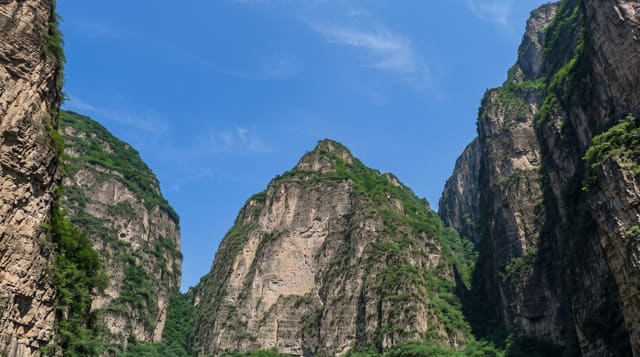
Gheris Gorges
A canyon and string of oasis villages east of Todra, on a road that carries almost no tourist traffic.
Updated 29 August 2026
The Gheris runs south out of the High Atlas parallel to the Todra one valley east, and the road that follows it from Rich down to Goulmima passes through a series of gorges and oasis villages that see a small fraction of the traffic Todra gets. The rock is red and grey limestone, the canyon narrows several times, and at each widening there is a palm oasis with a ksar - fortified earth villages, several of them substantially intact, at Amellago, Aït Morhad and others down the valley. Goulmima at the southern end has a large restored ksar with covered streets. What makes this route worth taking is exactly what it lacks: no tour buses, no touts, no carpet stops, and villages that are going about their business. The road is surfaced but narrow and the river crossings can flood. Fuel is scarce along it.
The landscape
- A parallel canyon to Todra - the same geology with almost none of the traffic.
- Oasis ksour - fortified earth villages at each widening of the valley.
- The Goulmima ksar - a large restored example with covered streets at the southern end.
- No tourist apparatus - no buses, touts or carpet stops on the route.
When to go
Spring and autumn. A day for the drive with stops.
What to expect
There is no tourist infrastructure - few cafes, scarce fuel and no guides on offer. River crossings flood after rain. Summer heat is severe. Villages are lived in; ask before photographing people or houses.
Nearby
Todra gorge is west; Errachidia and the Ziz valley are east.
What to pack for Gheris Gorges
Chosen from what this place is for. Tap a kit for the full checklist.
- Broken-in walking shoes or boots - Grip and ankle support matter more than looks; never hike in brand-new boots. Find on Amazon
- Layers + a waterproof shell - Mountain weather turns fast; a packable rain jacket saves the day. Find on Amazon
- Daypack with rain cover - 20-30 litres holds water, snacks, layers and a first-aid kit. Find on Amazon
- Offline maps + a power bank - Download the trail before you lose signal; carry backup charge. Find on Amazon
Some links on this page are Amazon affiliate links - if you buy through them we may earn a small commission at no extra cost to you.
All packing kitsPlan your trip
Where to start if Gheris Gorges is going on the list.
Booking links on this page are affiliate links - if you book through them we may earn a small commission at no extra cost to you. It never changes what we write about a place.
Opening times, ticket prices and seasonal closures change - check the official source before you go: official site.