Trnovacko Lake
A heart-shaped glacial lake under the Maglic massif, reached by a walk from the Montenegrin side.
Updated 21 October 2026
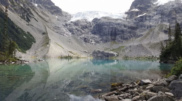
Trnovačko jezero lies at around fifteen hundred metres in a cirque below the Volujak and Maglić massifs near the Bosnian border, and its outline, roughly heart-shaped, has made it one of the most photographed lakes in the region. It is reached from the Montenegrin side by a rough track from the Piva valley and then a walk, or on foot from Bosnia. The water is very cold and the surrounding scree and peaks rise steeply on all sides.
Highlights
- The lake shape - the roughly heart-shaped outline seen from the ridges above.
- The cirque - the glacial bowl below Volujak and Maglic.
- The peaks - the limestone massifs enclosing the lake.
- The camping meadow - the flat ground at the lake used by walkers.
When to go
June to September; snow lies late and the track is impassable outside summer. July and August are the reliable window. Nights at the lake are cold in any month.
What to expect
The access track is rough and needs a proper four-wheel drive, then a walk. There are no facilities of any kind. The border is close and routes cross it, which needs care and the right documents.
Nearby
Piva Canyon is south, and Pluzine is beyond it.
Key facts
Source: Wikidata, item Q1811764, read on 18 October 2026.
What to pack for Trnovacko Lake
Chosen from what this place is for. Tap a kit for the full checklist.
- Broken-in walking shoes or boots - Grip and ankle support matter more than looks; never hike in brand-new boots. Find on Amazon
- Warm base layers - Merino or synthetic against the skin - never cotton, which chills when damp. Find on Amazon
- Shelter suited to the place - Tent, tarp or hut booking - match it to the terrain and rules. Find on Amazon
- Layers + a waterproof shell - Mountain weather turns fast; a packable rain jacket saves the day. Find on Amazon
Some links on this page are Amazon affiliate links - if you buy through them we may earn a small commission at no extra cost to you.
All packing kitsPlan your trip
Where to start if Trnovacko Lake is going on the list.
Booking links on this page are affiliate links - if you book through them we may earn a small commission at no extra cost to you. It never changes what we write about a place.
Opening times, ticket prices and seasonal closures change - check the official source before you go: official site.