Pulau Tinggi
A volcanic island with a distinctive peak that served as a landmark for shipping into the South China Sea.
Updated 29 August 2026
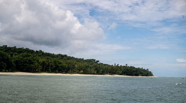
Tinggi means tall, and the island earns it: a volcanic cone rising to about six hundred metres from a base only a few kilometres across, which makes it visible from a long way out and gave it a role as a navigation mark on the old route between the Malay peninsula and China - Chinese sailors are said to have called it the general's hat. The forest on the slopes is intact and there is a waterfall on the western side. Villages sit on the coast, and a couple of resorts, one of which has opened and closed repeatedly over the years. Snorkelling is over fringing reef and the diving is decent without being outstanding. Climbing the peak is possible with a guide and is a hard, hot, unmaintained scramble rather than a trail walk.
What you'll find
- A volcanic cone - six hundred metres rising from a small island base.
- A shipping landmark - the profile used for navigation on the China route.
- A forest waterfall - on the western side of the island.
- Fringing reef - snorkelling and diving straight off the beaches.
When to go
March to October; closed during the monsoon. Two days.
What to expect
Resort operations here have been unreliable - confirm your booking is actually running. The peak climb is unmaintained and needs a guide. Facilities are limited and the island shuts for the monsoon.
Nearby
Sibu and Rawa are nearer the mainland; Mersing is the port.
Key facts
Source: Wikidata, item Q7413022, read on 18 October 2026.
What to pack for Pulau Tinggi
Chosen from what this place is for. Tap a kit for the full checklist.
- Broken-in walking shoes or boots - Grip and ankle support matter more than looks; never hike in brand-new boots. Find on Amazon
- Reef-safe sunscreen - High SPF that will not bleach the coral you are swimming over. Find on Amazon
- Your own mask + snorkel - A well-fitting mask is the single biggest comfort upgrade underwater. Find on Amazon
- Strong insect repellent - DEET or picaridin; the jungle is where bites and disease risk are highest. Find on Amazon
Some links on this page are Amazon affiliate links - if you buy through them we may earn a small commission at no extra cost to you.
All packing kitsPlan your trip
Where to start if Pulau Tinggi is going on the list.
Booking links on this page are affiliate links - if you book through them we may earn a small commission at no extra cost to you. It never changes what we write about a place.
Opening times, ticket prices and seasonal closures change - check the official source before you go: official site.