Mount Santubong
A steep isolated peak on the coast north of Kuching, with a rope-and-ladder summit trail and dolphins in the estuary below.
Updated 20 October 2026
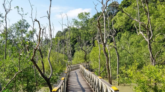
Santubong rises straight out of the sea on a peninsula less than an hour from Kuching, a little over eight hundred metres of forest and rock that looks harmless from the road and is not. The summit trail starts gently on a boardwalk, passes a couple of small waterfalls, then turns into a sustained climb up fixed ropes and aluminium ladders bolted to the rock, and most people take around four hours up and nearly as long down. Anyone who does not fancy that can walk the lower loops, which are flat and pleasant. In the estuary below, the Santubong and Salak rivers hold Irrawaddy dolphins and finless porpoises, and boat trips from the local jetty go looking for them in the afternoon.
History
To Iban and Malay people santubong means "coffin", while a Chinese reading is "the mountain visible a long way off". In 1974 and 1975 Haji Madzhi Johari wrote and sang the song Puteri Santubong, which became widely known (Wikipedia, Mount Santubong).
Highlights
- The summit ladders - fixed ropes and aluminium rungs on the upper rock sections.
- The lower waterfall loop - an easy boardwalk circuit for those skipping the climb.
- Irrawaddy dolphins - the estuary population looked for on afternoon boat trips.
- The peninsula beaches - the sand at Damai directly below the mountain.
When to go
Start the summit climb at first light, since the trail register usually cuts off ascents during the morning and being caught on the ladders in an afternoon storm is unpleasant. March to September is drier. Dolphin trips run in the afternoon and depend on tide and river conditions, so operators shift departure times from day to day.
What to expect
The summit is a hard climb rather than a walk, with long ladder sections that are exposed and slick in rain, and rescue would be slow. Views from the top are frequently closed in by cloud. There is no water on the route. Dolphin sightings are brief surfacings at a distance rather than the close encounters some photographs suggest.
Nearby
Damai beach and the Sarawak Cultural Village sit at the mountain's foot; Kuching is 45 minutes away.
Key facts
Source: Wikidata, item Q6923477, read on 18 October 2026.
What to pack for Mount Santubong
Chosen from what this place is for. Tap a kit for the full checklist.
- Broken-in walking shoes or boots - Grip and ankle support matter more than looks; never hike in brand-new boots. Find on Amazon
- Reef-safe sunscreen - High SPF that will not bleach the coral you are swimming over. Find on Amazon
- Binoculars - The single best wildlife tool - even a compact pair transforms a sighting. Find on Amazon
- Layers for big temperature swings - Warm sun by day, near-freezing at night, even near the equator. Find on Amazon
Some links on this page are Amazon affiliate links - if you buy through them we may earn a small commission at no extra cost to you.
All packing kitsPlan your trip
Where to start if Mount Santubong is going on the list.
Booking links on this page are affiliate links - if you book through them we may earn a small commission at no extra cost to you. It never changes what we write about a place.
Opening times, ticket prices and seasonal closures change - check the official source before you go: official site.