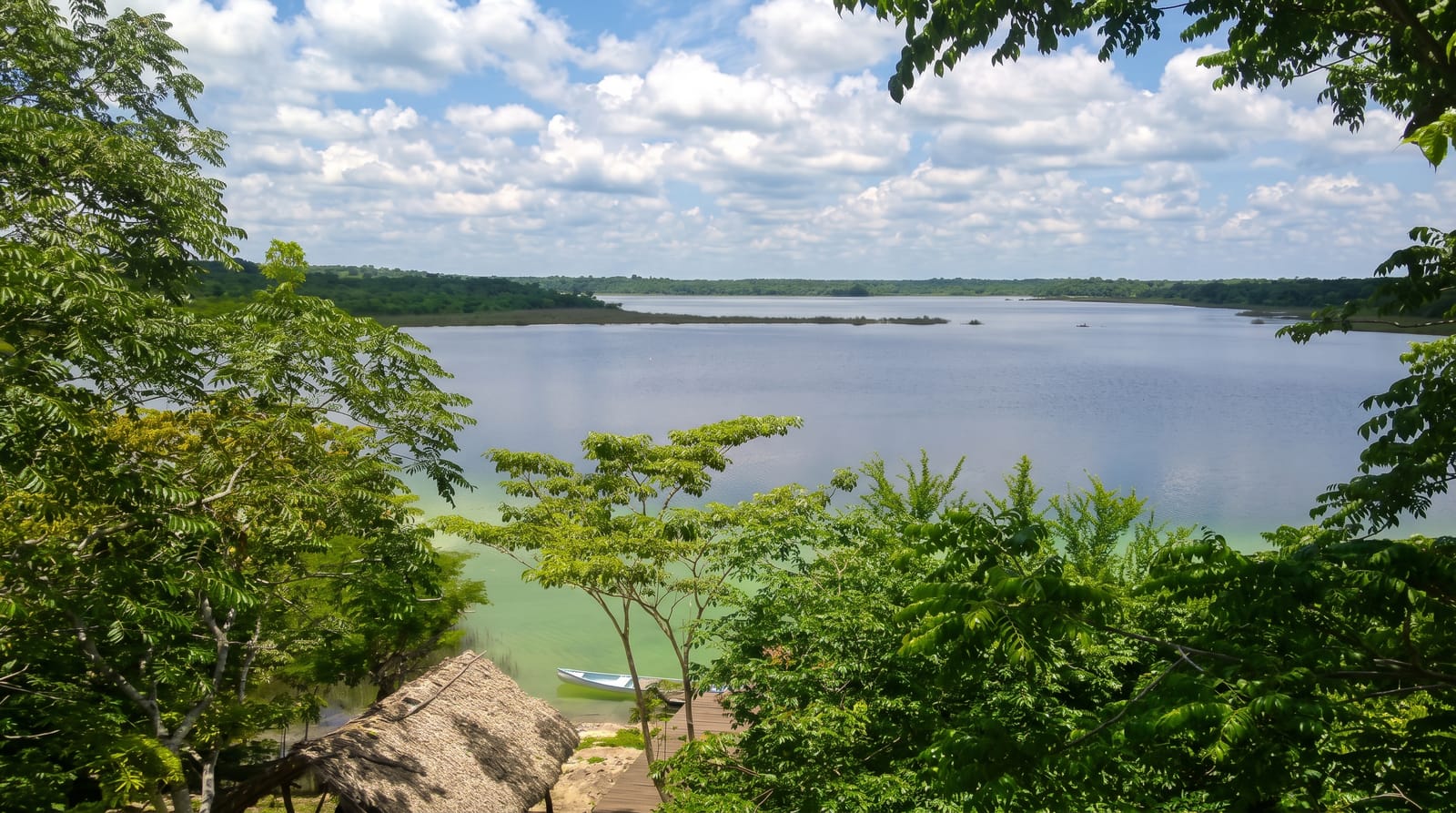
Xe Pian National Protected Area
Southern lowland forest and wetland where working elephants, hornbills and a hilltop ruin sit within a few kilometres of each other.
Updated 1 September 2026
Xe Pian runs across the flat country south of Pakse towards the Cambodian border, and it protects the sort of habitat that has largely gone elsewhere in the lower Mekong: semi-evergreen and dry dipterocarp forest, seasonal wetland, and river channels with deep pools. Kiet Ngong village on the edge of the Beung Kiat Ngong wetland is the usual base, and it is one of the last places in Laos where domesticated elephants are still part of village life rather than an attraction imported for visitors.
The landscape
- The Beung Kiat Ngong wetland - a Ramsar-listed marsh with a boardwalk and observation platform.
- The dipterocarp forest - open, dry, fire-adapted woodland unlike the closed forest further north.
- Phou Asa - a hilltop above the village ringed by unexplained stone columns.
- The birds - hornbills, storks and ibis among the species the wetland holds.
When to go
November to March is dry, cool by local standards and the best time for walking. The wetland is fullest at the end of the wet season around October, when the birds concentrate. April and May are punishingly hot on open ground.
Good to know
The elephant question is worth thinking about before arriving: some village operations offer riding, and there is a real difference between watching and mounting. Wildlife here is thin on the ground and shy after decades of hunting pressure, so this is habitat rather than a safari. Accommodation is homestay level.
Nearby
The Four Thousand Islands are south along the Mekong, and Champasak and Wat Phou lie northwest.
Key facts
Source: Wikidata, item Q25051434, read on 18 October 2026.
What to pack for Xe Pian National Protected Area
Chosen from what this place is for. Tap a kit for the full checklist.
- Broken-in walking shoes or boots - Grip and ankle support matter more than looks; never hike in brand-new boots. Find on Amazon
- Binoculars - The single best wildlife tool - even a compact pair transforms a sighting. Find on Amazon
- Layers + a waterproof shell - Mountain weather turns fast; a packable rain jacket saves the day. Find on Amazon
- A zoom camera or long lens - Animals rarely come close; reach beats megapixels. Find on Amazon
Some links on this page are Amazon affiliate links - if you buy through them we may earn a small commission at no extra cost to you.
All packing kitsPlan your trip
Where to start if Xe Pian National Protected Area is going on the list.
Booking links on this page are affiliate links - if you book through them we may earn a small commission at no extra cost to you. It never changes what we write about a place.
Opening times, ticket prices and seasonal closures change - check the official source before you go: official site.