Twelve Bens
A compact range of bare quartzite cones at the centre of Connemara, steep and stony and much harder than their height suggests.
Updated 28 August 2026
The Twelve Bens, Na Beanna Beola, are a tight cluster of quartzite peaks in central Connemara, the highest being Benbaun at 729 metres. They are not high by any international standard but they are unusually demanding for their size: the rock is bare, the slopes are steep and covered in loose scree and slabs, there are almost no paths, and the ground between the peaks is deep wet bog. The classic outing is a horseshoe linking several summits, which involves repeated steep descents and reascents on rough ground. Diamond Hill at Letterfrack, on the range's northern edge, is the exception - boardwalked and manageable - and is where most visitors go. Weather here changes without warning and the peaks hold cloud most days, which matters because there is nothing to navigate by on featureless quartzite. Rescue callouts in the Bens are frequent.
The landscape
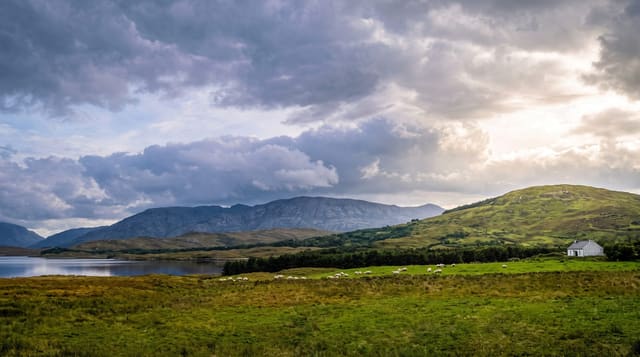
- The quartzite cones - bare, pale, steep-sided peaks in a tight group.
- Benbaun - 729 metres, the highest of the range.
- The bog between - deep wet ground linking the summits.
- Diamond Hill - the boardwalked exception at Letterfrack.
When to go
May to September. Cloud sits on the tops most days; wait for a clear forecast and start early. Winter here needs full mountain equipment and skills.
What to expect
Steep loose scree, no paths, and deep bog between peaks - much harder than the modest heights suggest. Navigation on bare quartzite in cloud is genuinely difficult. Frequent rescue callouts. Land is farmed; access depends on goodwill.
Nearby
Connemara National Park is at Letterfrack; Killary Harbour is north and Roundstone south.
Key facts
Source: Wikidata, item Q1093773, read on 18 October 2026.
What to pack for Twelve Bens
Chosen from what this place is for. Tap a kit for the full checklist.
- Broken-in walking shoes or boots - Grip and ankle support matter more than looks; never hike in brand-new boots. Find on Amazon
- Layers + a waterproof shell - Mountain weather turns fast; a packable rain jacket saves the day. Find on Amazon
- Daypack with rain cover - 20-30 litres holds water, snacks, layers and a first-aid kit. Find on Amazon
- Offline maps + a power bank - Download the trail before you lose signal; carry backup charge. Find on Amazon
Some links on this page are Amazon affiliate links - if you buy through them we may earn a small commission at no extra cost to you.
All packing kitsPlan your trip
Where to start if Twelve Bens is going on the list.
Booking links on this page are affiliate links - if you book through them we may earn a small commission at no extra cost to you. It never changes what we write about a place.
Opening times, ticket prices and seasonal closures change - check the official source before you go: official site.