Lugnaquilla
Leinster's highest mountain at 925 metres, a broad flat plateau summit with two corries bitten out of its sides.
Updated 21 October 2026
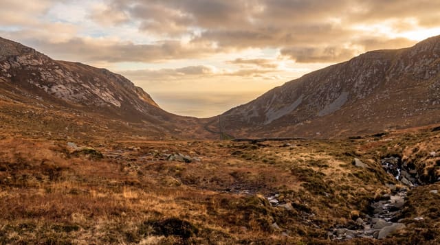
Lugnaquilla is 925 metres, the highest point in Leinster and the highest mountain in Ireland outside the Munster ranges. Its summit is not a peak but a wide flat plateau of grass and stone, known as Percy's Table after an eighteenth-century landowner, and two deep corries - the North Prison and the South Prison - cut into its flanks by glaciers. The commonest route starts from Baravore in Glenmalure and climbs steadily for about five hours return. The plateau is the danger: in cloud, which is frequent, there is nothing to navigate by and walkers have wandered over the edge of the prisons. Map, compass and the ability to use them are not optional here. The western approaches cross the Glen of Imaal artillery range, which is live and controlled by the Defence Forces; firing times are published and entering the danger area when red flags are flying is both illegal and lethal.
What's there
- The plateau summit - flat, broad, and featureless in cloud.
- The two prisons - the North and South corries cut into the flanks.
- The Glenmalure approach - the standard route from Baravore.
- The height - 925 metres, the highest ground in Leinster.
When to go
May to September for the longest daylight and the driest ground. Cloud covers the summit on most days of the year; pick a clear forecast and start early.
Before you go
The flat summit is genuinely dangerous in poor visibility - navigate by map and compass, not by sight. Five to seven hours of rough boggy walking. The western side crosses a live artillery range; check the firing schedule and never pass a red flag.
Nearby
Glenmalure and Glendalough are north-east; the Glen of Imaal is west.
Key facts
Source: Wikidata, item Q514648, read on 18 October 2026.
What to pack for Lugnaquilla
Chosen from what this place is for. Tap a kit for the full checklist.
- Broken-in walking shoes or boots - Grip and ankle support matter more than looks; never hike in brand-new boots. Find on Amazon
- Warm base layers - Merino or synthetic against the skin - never cotton, which chills when damp. Find on Amazon
- Layers for big temperature swings - Warm sun by day, near-freezing at night, even near the equator. Find on Amazon
- Layers + a waterproof shell - Mountain weather turns fast; a packable rain jacket saves the day. Find on Amazon
Some links on this page are Amazon affiliate links - if you buy through them we may earn a small commission at no extra cost to you.
All packing kitsPlan your trip
Where to start if Lugnaquilla is going on the list.
Booking links on this page are affiliate links - if you book through them we may earn a small commission at no extra cost to you. It never changes what we write about a place.
Opening times, ticket prices and seasonal closures change - check the official source before you go: official site.