Tanjung Puting National Park
A Borneo peat-swamp park visited by liveaboard klotok up the Sekonyer river, and the site of Camp Leakey.
Updated 29 August 2026
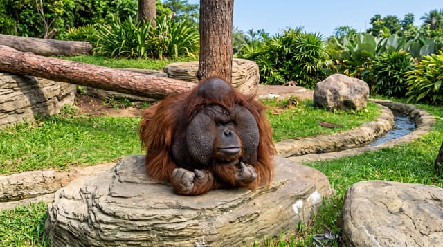
Tanjung Puting covers about four thousand square kilometres of peat swamp, heath and lowland forest on the southern coast of Kalimantan, and the way to see it is by klotok - a wooden riverboat that becomes your accommodation, chugging up the Sekonyer with mattresses laid on the roof deck and meals cooked aboard, tying up at night in the forest. Camp Leakey, established in 1971 by Biruté Galdikas, is the longest-running orangutan research station in the world and is on the itinerary along with two other feeding platforms where rehabilitated and semi-wild orangutans come in. Proboscis monkeys, gibbons and hornbills line the river. The park's pressures are real: illegal gold mining has polluted parts of the Sekonyer, and oil palm presses on the boundaries.
Highlights
- Sleeping on a klotok - the riverboat as transport and accommodation.
- Camp Leakey - the longest-running orangutan research station in the world.
- Feeding platforms - rehabilitated and semi-wild orangutans coming in.
- Proboscis monkeys on the river - the Borneo endemic along the banks at dusk.
When to go
June to September. Three days.
Before you go
Orangutans at feeding platforms are semi-wild and habituated - this is not chance wildlife watching. Mining pollution has discoloured stretches of the Sekonyer. Klotok charters are the main cost.
Nearby
Kumai is the port; Pangkalan Bun has the airport.
Key facts
Source: Wikidata, item Q1378379, read on 18 October 2026.
What to pack for Tanjung Puting National Park
Chosen from what this place is for. Tap a kit for the full checklist.
- Broken-in walking shoes or boots - Grip and ankle support matter more than looks; never hike in brand-new boots. Find on Amazon
- Binoculars - The single best wildlife tool - even a compact pair transforms a sighting. Find on Amazon
- Layers + a waterproof shell - Mountain weather turns fast; a packable rain jacket saves the day. Find on Amazon
- A zoom camera or long lens - Animals rarely come close; reach beats megapixels. Find on Amazon
Some links on this page are Amazon affiliate links - if you buy through them we may earn a small commission at no extra cost to you.
All packing kitsPlan your trip
Where to start if Tanjung Puting National Park is going on the list.
Booking links on this page are affiliate links - if you book through them we may earn a small commission at no extra cost to you. It never changes what we write about a place.
Opening times, ticket prices and seasonal closures change - check the official source before you go: official site.