Trollaskagi Drive
A coast road round a mountain peninsula, strung together by tunnels that ended the isolation of its villages.
Updated 30 August 2026
Trollaskagi is the mountainous peninsula between Skagafjordur and Eyjafjordur, high enough and steep enough that its northern villages were effectively cut off for much of the year until tunnelling changed that - the Heidinsfjardargong, opened in 2010, joined Siglufjordur and Olafsfjordur through the mountain and through the abandoned valley of Heidinsfjordur in between. Driving the loop takes in Siglufjordur with its herring museum, Olafsfjordur, Dalvik, Hofsos with its cliff-edge pool, and a coastline of steep fjords under peaks. Ski touring in spring is a growing reason to come.
What to look for
- Tunnels that ended isolation - Heidinsfjordur opened in 2010.
- Siglufjordur and the herring - the town the boom built and left.
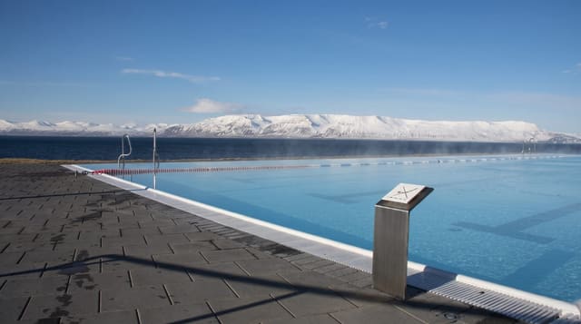
- Hofsos and its pool - swimming on the edge of the fjord.
- Steep peaks over the coast - the ground that made the tunnels necessary.
When to go
June to September for easy driving; spring for ski touring. A full day.
Before you go
Winter driving here is genuinely demanding and roads close. Some tunnels are single lane with passing bays, which unsettles first-timers. Services in the smaller villages are seasonal. The loop is longer than the map suggests.
Nearby
Akureyri is at the eastern end; Saudarkrokur and Drangey are west.
What to pack for Trollaskagi Drive
Chosen from what this place is for. Tap a kit for the full checklist.
- Reef-safe sunscreen - High SPF that will not bleach the coral you are swimming over. Find on Amazon
- Comfortable walking shoes - Sightseeing means kilometres of pavement and cobbles daily. Find on Amazon
- Quick-dry towel - A microfibre towel packs small and dries in minutes. Find on Amazon
- A slim anti-theft daypack - Zips that close properly; keep it in front in crowds and on transit. Find on Amazon
Some links on this page are Amazon affiliate links - if you buy through them we may earn a small commission at no extra cost to you.
All packing kitsPlan your trip
Where to start if Trollaskagi Drive is going on the list.
Booking links on this page are affiliate links - if you book through them we may earn a small commission at no extra cost to you. It never changes what we write about a place.
Opening times, ticket prices and seasonal closures change - check the official source before you go: official site.