Thorsmork
A birch-covered valley ringed by three ice caps, reached only by river-fording highland buses or serious 4x4 vehicles in summer.
Updated 30 August 2026
AI illustration
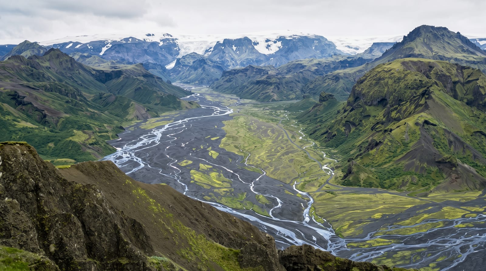
Thorsmork is a valley enclosed by the Eyjafjallajokull, Myrdalsjokull and Tindfjallajokull ice caps, sheltered enough that dwarf birch and willow grow thickly on slopes that are bare everywhere else in the region. Braided glacial rivers run across the floor, and the access track crosses several of them without bridges, including the Krossa, which is why ordinary rental cars are not permitted and the highland buses sit high on their axles. Once inside there are huts and campsites at Langidalur, Husadalur and Basar, and a network of day walks up ridges such as Valahnukur. The Laugavegur trek from Landmannalaugar ends here, and the Fimmvorduhals route continues over the pass to Skogar.
Highlights
- The birch woods - dense dwarf birch and willow, unusual for the Icelandic interior.
- Valahnukur - a short steep climb to a ridge above the huts overlooking the braided rivers.
- The river crossings - unbridged glacial fords on the approach, taken slowly by the buses.
- Trail junctions - the end of the Laugavegur trek and the start of the Fimmvorduhals crossing to Skogar.
When to go
The valley is served from late June to early September, when the highland buses run and the huts are staffed. Outside that the road is unmaintained and the rivers are unpredictable. Book hut beds well ahead in July and August, when Laugavegur trekkers fill them. Weather changes quickly even at the height of summer.
What to expect
You cannot drive here in a normal car, and rental agreements void insurance for water damage at the fords; vehicles are pulled out of the Krossa every summer. The bus takes a few hours each way. Facilities are basic, huts get crowded, and rain can settle in for days. Fimmvorduhals is a long, exposed full-day walk.
Nearby
Seljalandsfoss and the ring road are on the drive in, and the Laugavegur trail leads north to Landmannalaugar.
Key facts
Source: Wikidata, item Q138114, read on 18 October 2026.
What to pack for Thorsmork
Chosen from what this place is for. Tap a kit for the full checklist.
- Broken-in walking shoes or boots - Grip and ankle support matter more than looks; never hike in brand-new boots. Find on Amazon
- Shelter suited to the place - Tent, tarp or hut booking - match it to the terrain and rules. Find on Amazon
- Layers + a waterproof shell - Mountain weather turns fast; a packable rain jacket saves the day. Find on Amazon
- A warm sleeping bag + mat - Rated a little colder than you expect the nights to be. Find on Amazon
Some links on this page are Amazon affiliate links - if you buy through them we may earn a small commission at no extra cost to you.
All packing kitsPlan your trip
Where to start if Thorsmork is going on the list.
Booking links on this page are affiliate links - if you book through them we may earn a small commission at no extra cost to you. It never changes what we write about a place.
Opening times, ticket prices and seasonal closures change - check the official source before you go: official site.