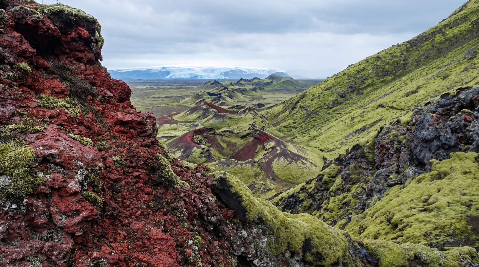
Lakagigar Crater Row
A row of scores of craters running for tens of kilometres across the highlands north of Kirkjubaejarklaustur, now covered in thick moss.
Updated 30 August 2026
AI illustration
UNESCO World Heritage
In the 1780s a fissure opened in the highlands north of Kirkjubaejarklaustur and erupted for months, putting out an enormous volume of lava and a haze that ruined grazing across the country and brought years of hunger behind it. What is left is Lakagigar: a line of craters, scores of them, running across the upland in a more or less straight row with the hill of Laki about halfway along. Moss has covered most of it, so the cones read as soft green mounds with red and black cinder showing through. From the top of Laki the row is visible stretching away in both directions, which is the only way to take in the scale of it.
Highlights
- The crater row - cones lined up along the fissure, running toward the horizon both ways.
- Laki hill - a climb of roughly half an hour for the view along the whole row.
- The moss cover - thick grey-green moss grown over old lava and cinder.
- The lava field - the flow that ran south from here and reached the lowland farms.
When to go
The track opens when the rivers drop, usually late June, and closes again with the first serious weather in September. It is a full day from the ring road and back with no fuel or food on the way. A guided day trip out of Kirkjubaejarklaustur removes the driving problem, and that is what most visitors end up doing.
Good to know
F206 is genuinely rough, with river crossings that are not bridged and that change depth through the day; a small four-wheel drive is not always enough, and insurance does not cover water damage. There is no signal for most of it. Cloud sits on the highland often, and in it the craters are grey humps and nothing more.
Nearby
Kirkjubaejarklaustur and the moss-covered lava along the ring road are the way in and out.
Key facts
Source: Wikidata, item Q203726, read on 18 October 2026.
What to pack for Lakagigar Crater Row
Chosen from what this place is for. Tap a kit for the full checklist.
- Broken-in walking shoes or boots - Grip and ankle support matter more than looks; never hike in brand-new boots. Find on Amazon
- Spare batteries + cards - Cold and long shoots drain power; never run out at the good light. Find on Amazon
- Layers + a waterproof shell - Mountain weather turns fast; a packable rain jacket saves the day. Find on Amazon
- A compact tripod - Essential for night skies, aurora, waterfalls and low light. Find on Amazon
Some links on this page are Amazon affiliate links - if you buy through them we may earn a small commission at no extra cost to you.
All packing kitsPlan your trip
Where to start if Lakagigar Crater Row is going on the list.
Booking links on this page are affiliate links - if you book through them we may earn a small commission at no extra cost to you. It never changes what we write about a place.
Opening times, ticket prices and seasonal closures change - check the official source before you go: official site.