San Javier
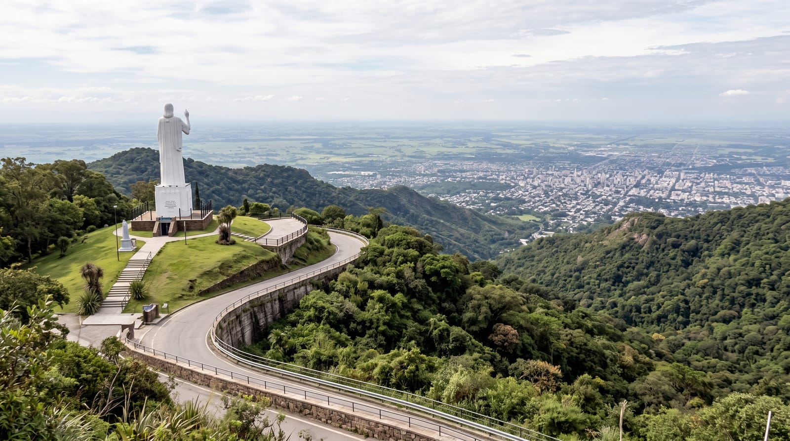
The forested hill above Tucumán crowned by a great statue of Christ, with a balcony road looking out over the city and the plains beyond.
Updated 4 September 2026
AI illustration
The Sierra de San Javier rises directly behind Tucumán, and the road that climbs it passes from sugar cane through dense subtropical forest to open ridge in less than half an hour. At the top stands the Cristo Bendicente, a stone statue of Christ some twenty-eight metres tall set on the crest, arms raised over the valley, begun in the 1940s and long a landmark visible from the city below. The real attraction is the view: on clear days the whole Tucumán plain spreads out to the east, the city a grid of pale blocks with the mountains falling away in green folds. The university maintains a biological reserve on the range, protecting yungas forest with walking trails, and the ridge road has viewpoints, cafes and paragliding launch points.
What to look for
- The Cristo Bendicente - the tall stone statue on the ridge above the city.
- The plain view - Tucumán and the lowlands spread out to the east.
- The forest reserve - yungas trails maintained by the university.
- The paragliders - launches from the ridge on good days.
When to go
April to November for the clearest air; summer haze and afternoon storms often erase the view entirely. Early morning is best. Weekends bring heavy local traffic on the narrow road.
What to expect
Cloud and haze hide the view on a good share of days, and the statue itself is weathered and modest up close. The road is narrow and busy at weekends. There is little to do beyond looking, walking a trail and having a coffee.
Nearby
Villa Nougués sits on the same range; Tucumán city is twenty minutes below.
What to pack for San Javier
Chosen from what this place is for. Tap a kit for the full checklist.
- Broken-in walking shoes or boots - Grip and ankle support matter more than looks; never hike in brand-new boots. Find on Amazon
- Spare batteries + cards - Cold and long shoots drain power; never run out at the good light. Find on Amazon
- Strong insect repellent - DEET or picaridin; the jungle is where bites and disease risk are highest. Find on Amazon
- Layers + a waterproof shell - Mountain weather turns fast; a packable rain jacket saves the day. Find on Amazon
Some links on this page are Amazon affiliate links - if you buy through them we may earn a small commission at no extra cost to you.
All packing kitsPlan your trip
Where to start if San Javier is going on the list.
Booking links on this page are affiliate links - if you book through them we may earn a small commission at no extra cost to you. It never changes what we write about a place.
Opening times, ticket prices and seasonal closures change - check the official source before you go: official site.