Fjadrargljufur Canyon
A serpentine canyon about two kilometres long and up to a hundred metres deep, with a footpath along the rim.
Updated 12 October 2026
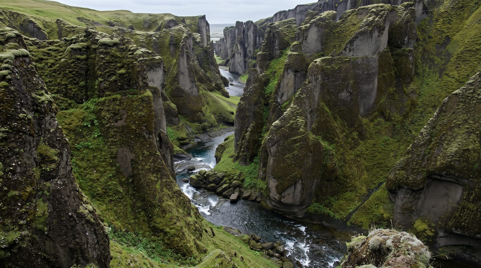
AI illustration
Fjadrargljufur is a narrow, winding gorge cut into soft palagonite rock by the Fjadra river, roughly two kilometres long and up to about a hundred metres deep. The walls fold back on themselves in a series of green-topped fins, which is why photographs of it look almost artificial. A marked path runs along the eastern rim to a platform at the top end, and a rougher route follows the riverbed itself when water levels allow. The moss and thin turf on the edges damage easily, and the site has been closed for weeks at a time in spring to let vegetation recover. It is a short stop rather than a walk of any length.
Highlights
- The rim path - the marked trail along the eastern edge with several fenced viewpoints.
- The upper platform - the viewing deck at the head of the gorge looking back down its bends.
- The folded walls - palagonite fins the river has cut into tight curves.
- The riverbed route - the wet walk along the canyon floor, possible only in low water.
When to go
Summer, once the spring closure has been lifted and the path has dried out. Mornings are quieter; by late morning the car park fills with south coast tour traffic. Check the closure status before setting off, since the site is shut for several weeks most springs while the vegetation on the rim regrows.
Practical notes
It is busy, small and takes under an hour. The path is muddy and slippery in wet weather, and the fenced viewpoints are narrow, so people queue for the good angles. Straying off the trail is both damaging and dangerous. Spring closures are enforced and drivers regularly arrive to find the gate shut.
Nearby
Kirkjubaejarklaustur lies east along the ring road and the Eldhraun lava field west.
Key facts
Source: Wikidata, item Q956845, read on 18 October 2026.
What to pack for Fjadrargljufur Canyon
Chosen from what this place is for. Tap a kit for the full checklist.
- Broken-in walking shoes or boots - Grip and ankle support matter more than looks; never hike in brand-new boots. Find on Amazon
- Layers + a waterproof shell - Mountain weather turns fast; a packable rain jacket saves the day. Find on Amazon
- Daypack with rain cover - 20-30 litres holds water, snacks, layers and a first-aid kit. Find on Amazon
- Offline maps + a power bank - Download the trail before you lose signal; carry backup charge. Find on Amazon
Some links on this page are Amazon affiliate links - if you buy through them we may earn a small commission at no extra cost to you.
All packing kitsPlan your trip
Where to start if Fjadrargljufur Canyon is going on the list.
Booking links on this page are affiliate links - if you book through them we may earn a small commission at no extra cost to you. It never changes what we write about a place.
Opening times, ticket prices and seasonal closures change - check the official source before you go: official site.